
DAYTON — Good Sunday evening, everyone! It sure was an awesome end to the weekend with sunshine and warm temperatures. Weather Specialist Nick Dunn here to talk about some big, and for some like welcomed, changes ahead this week!
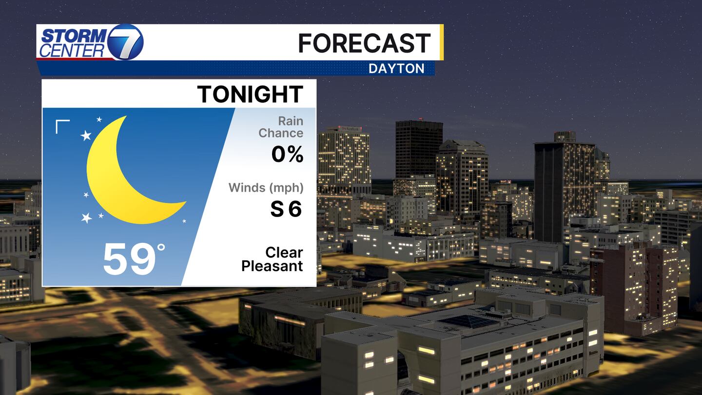
Starting things off, we are quiet all night into the start of your Monday. Lows will be in the upper 50s to around 60 and it will be mostly clear.
[DOWNLOAD: Free Storm Center 7 Weather app for alerts as news breaks]
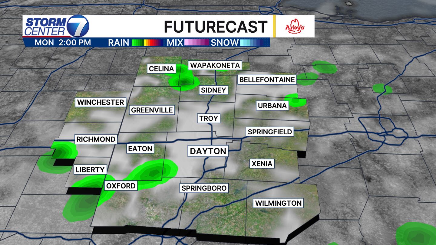
While Monday starts quiet, we may find a few pop-up showers late in the day. You will notice some cloud cover thickening up and a bit of a muggy feel to the air as well. This rain looks isolated in nature and is not the main rain chance this week.
By early Tuesday morning, a bigger push of rain and a few thunderstorms is likely. While it will not necessarily be a constant, all-day rain, we will find some pockets of soaking rain that will be helpful to our drought conditions.
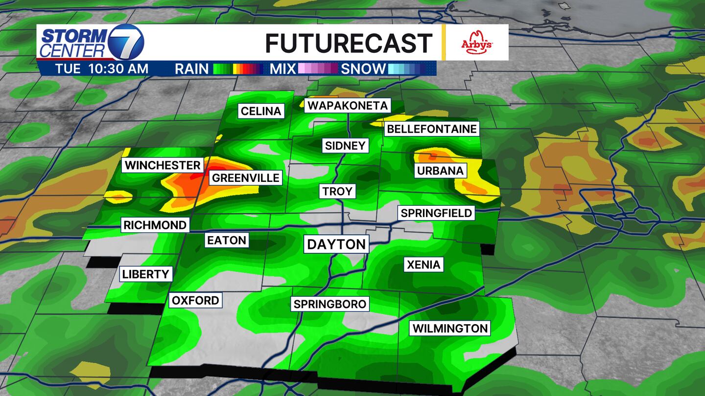
When rain wraps up Tuesday night, we should find rainfall totals generally in the 0.50-1.00″ range. However, if multiple downpours fall over your location, a few locally higher totals to 1.50″ are not out of the question. Some guidance is a bit “heavy” and showing over 2 inches is possible. We will see how things trend in the final hours later on Monday, but this could be something to keep an eye on.

[WATCH Storm Center 7 Weather on the following devices]
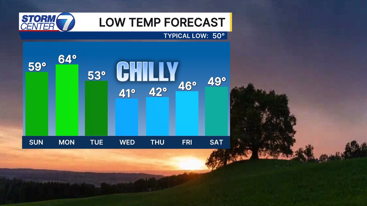
Behind this front, we have some real Fall chill on the way with an extended stretch of lows in the 40s and highs in the middle 60s to lower 70s. A few upper 30s are possible on early Thursday and Friday mornings!
Have a great week! Be sure you have our free WHIO Weather app on your devices to track the rain and enable notifications to know when rain is about to start near you!


