
DAYTON — Good evening, everyone! Happy Saturday to you! I hope you are staying warm. Meteorologist Nick Dunn here on what has been a very cold day with pesky flurries and light snow around. Not enough to add up to much, but a reminder that Winter is in full control!
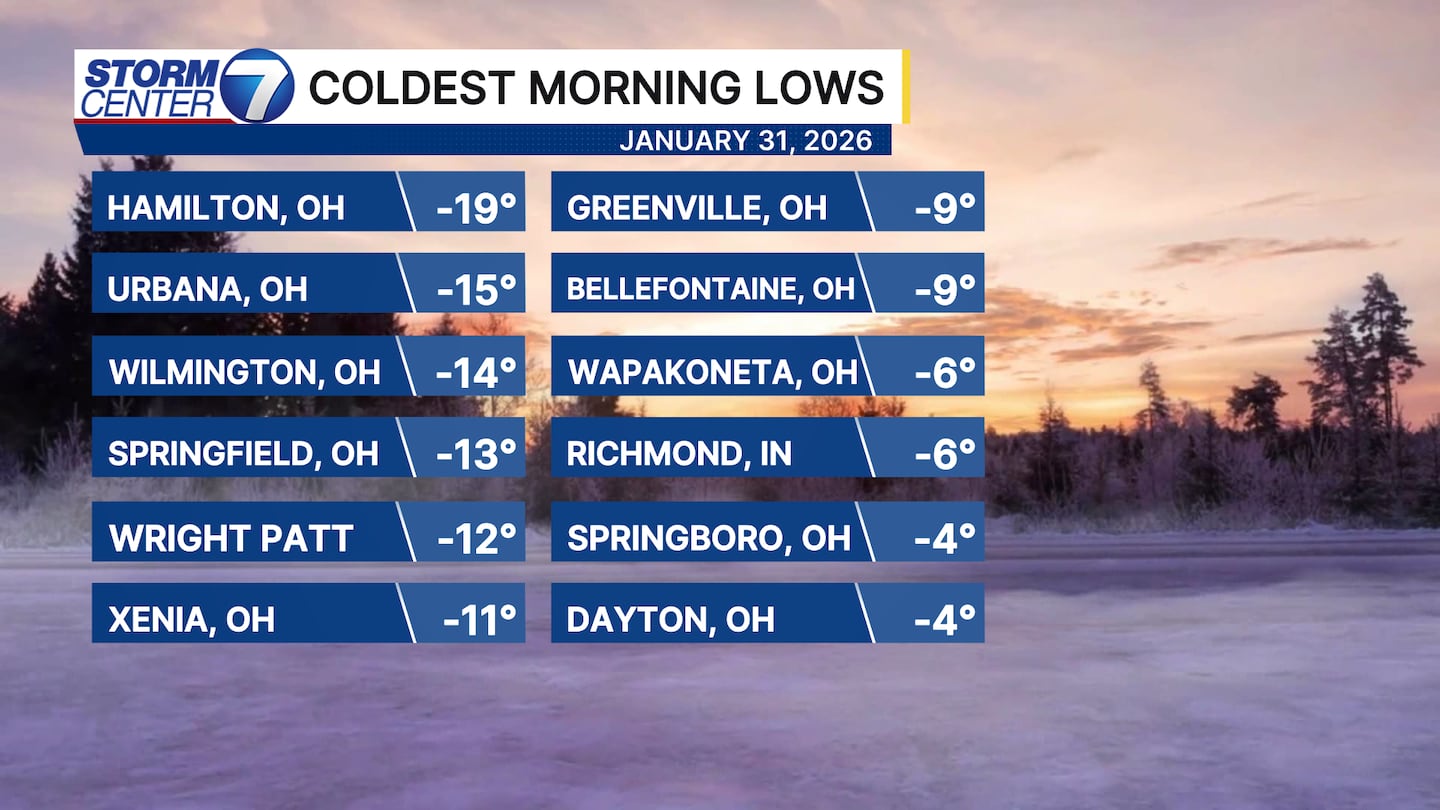
Here is a look at just how cold our communities got this morning! Everyone dropped below zero, but check out Hamilton in Butler County...approaching -20 degrees today! That makes you cold just reading it!
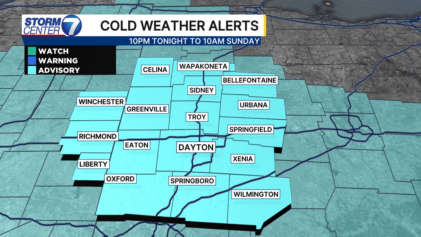
A Cold Weather Advisory is in effect for everyone tonight due to wind chills nearing -10 to -15 for Sunday morning. We know the routine by now for sure! Bundle up and limit time outdoors if possible.
[DOWNLOAD: Free Storm Center 7 Weather app for alerts as news breaks]
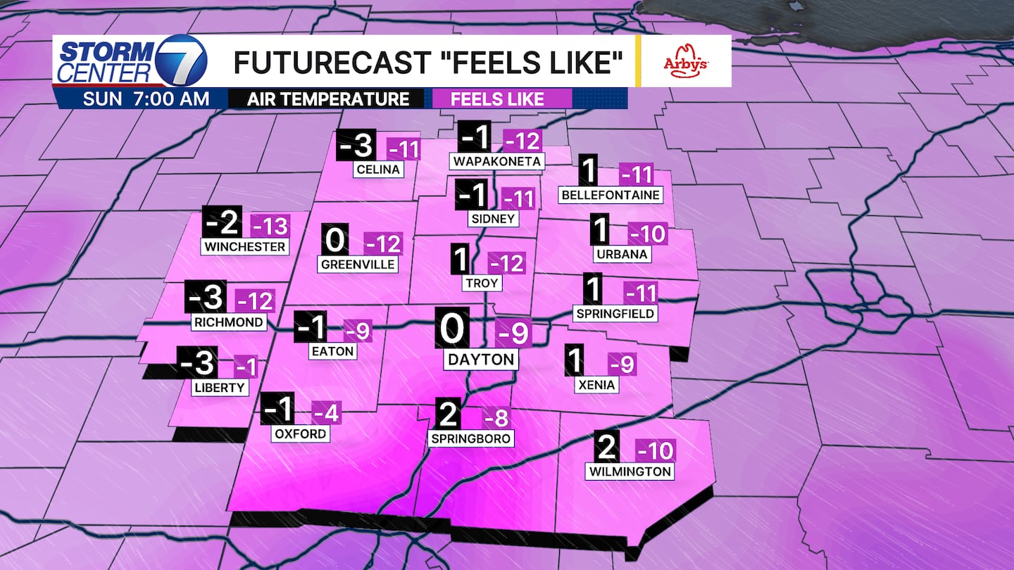
Here is a look at the future air temperatures and wind chills for Sunday morning! I think most, if not all, of us avoid air temperatures as cold as this morning.
Still, wind chills at or below -10 tell us a chance of frostbite increases and can occur within about 30 minutes at or below that threshold.
[WATCH Storm Center 7 Weather on the following devices]
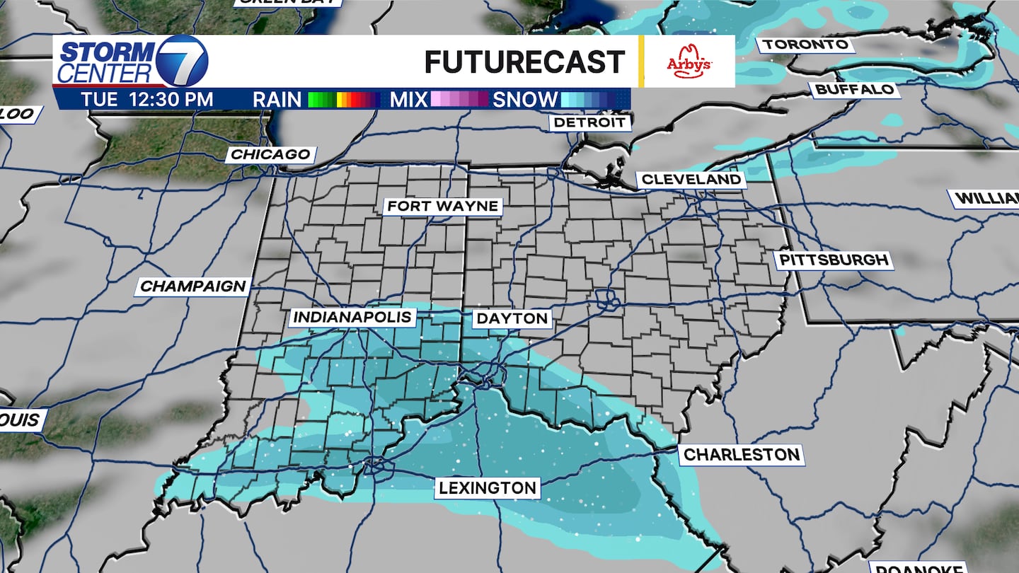
There are a couple small snow chances in the forecast as well after tonight’s flurries end. The first arrives on Monday in the form of a few flurries or light snow showers. A system on Tuesday could bring light snow accumulations of around 1″ or less near and south of I-70. We will watch that closely.
The pattern stays a bit active into the end of the week with another clipper system diving southeast and another chance of snow showers for Friday.
©2026 Cox Media Group


