
DAYTON — Happy Saturday, everyone! Weather Specialist Nick Dunn here this evening to break down the forecast. We had a very warm day to kick off the weekend with a high of 85 degrees in Dayton! That is close to 15 degrees above where we typically expect for early October.
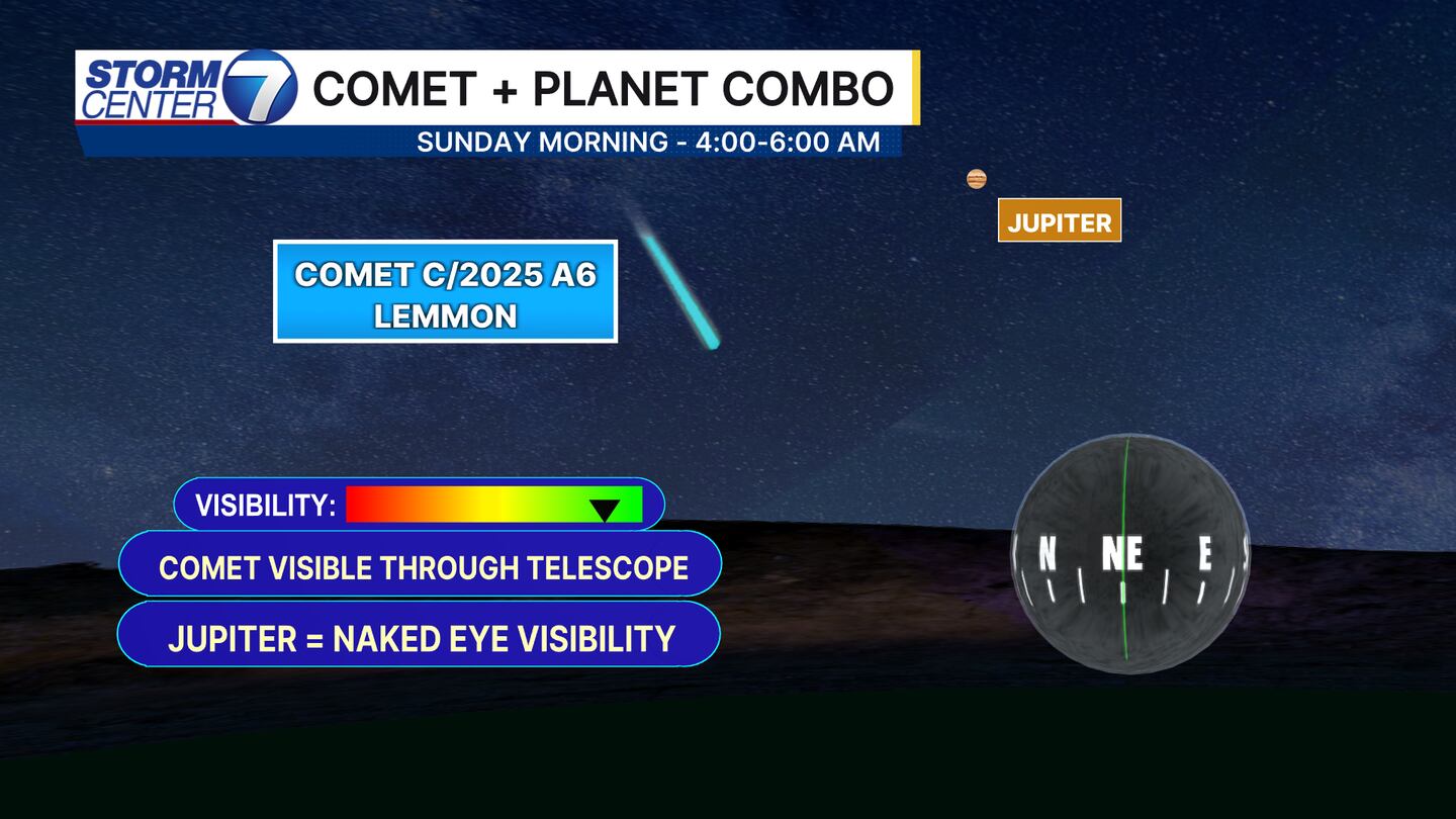
If you are up super early in the morning and have the right equipment, you can see a comet if you look northeast between 4:00 AM and 6:00 AM Sunday morning! You can check out this post on my Facebook page to see what it looks like!
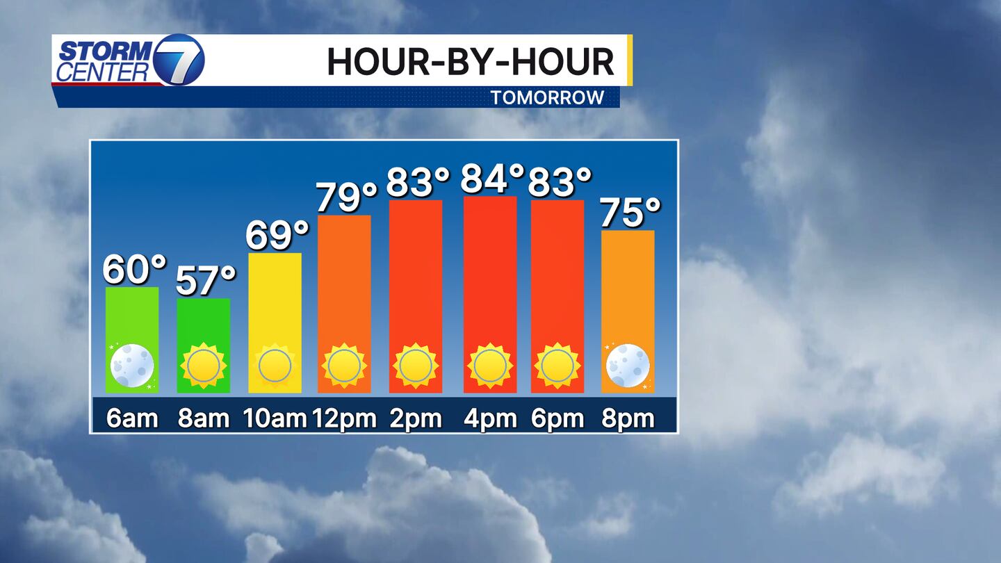
Sunday will be a relatively toasty day for early October with wall-to-wall sunshine and highs in the middle 80s once again. No threat for rain is expected to end the weekend, but that all changes as we head into next week.
[DOWNLOAD: Free Storm Center 7 Weather app for alerts as news breaks]

While we have a slim chance (20%) of a late-day shower or storm on Monday, we find ourselves in a great spot to see rain Tuesday. The rain chances for Tuesday are higher due to a cold front approaching with increased moisture in place. This will help produce “lift” for showers and a few storms to develop. Some heavy downpours are possible, but severe weather is not expected.
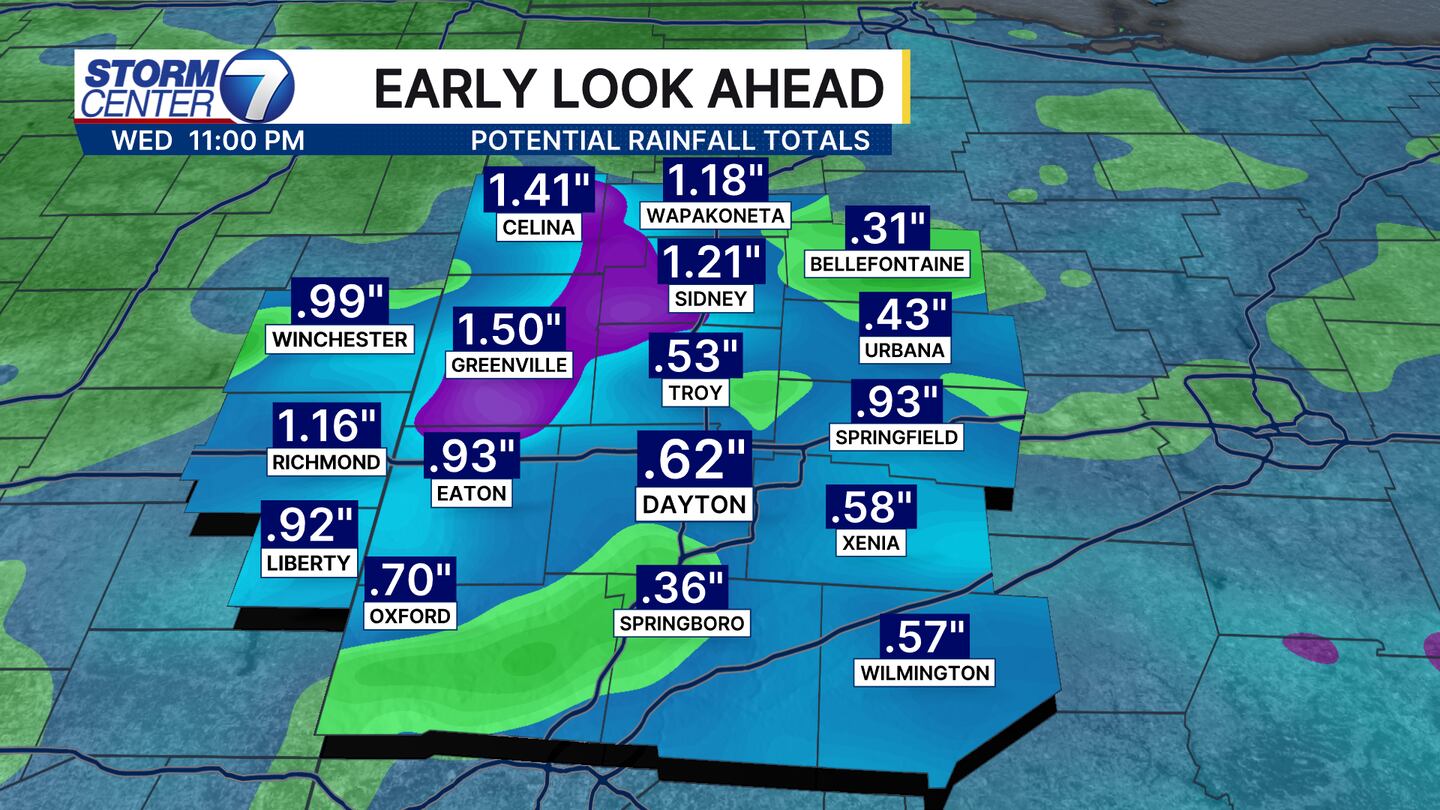
While it is not an all-day rainfall, some heavy downpours that fall could produce some isolated pockets of greater than 1 inch of rain. Otherwise, widespread totals averaging 0.50″ are pretty likely at this point. A few minor tweaks to the rainfall forecast are possible as we get closer, but a solid event is looking likely.
[WATCH Storm Center 7 Weather on the following devices]
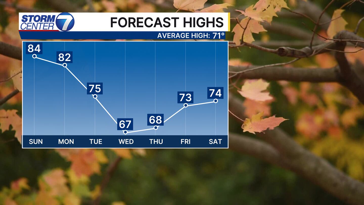
Behind that system, we get a nice break from warm temperatures! Highs will fall into the 60s for a few days before we climb into the low and mid 70s by next Saturday. Have a great night!


