
DAYTON — Good afternoon, everyone! Weather Specialist Nick Dunn here on this Wednesday to break down what we are keeping our eyes on in the days ahead. The theme through Friday will be dry weather with cool mornings and seasonable afternoons!
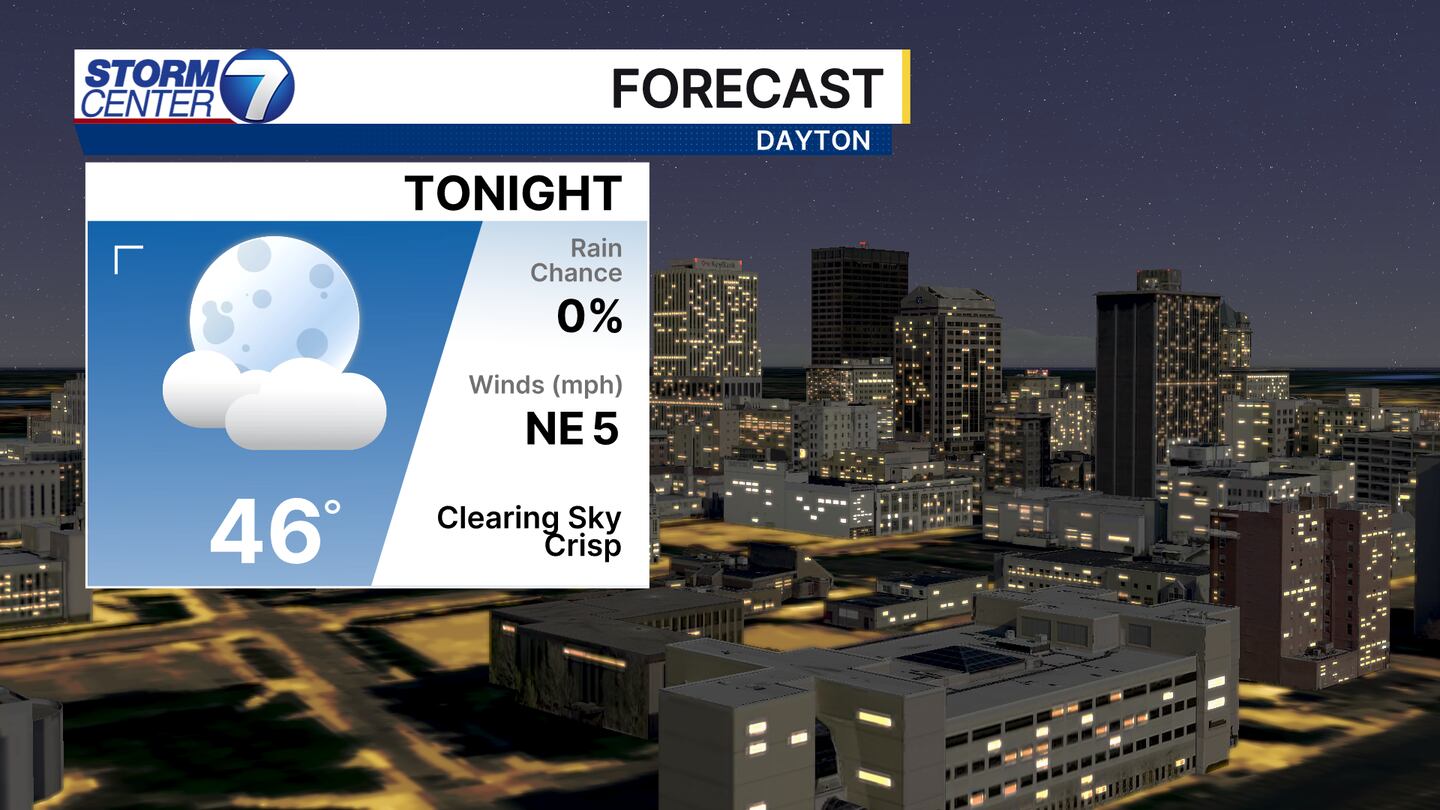
After a cloudy start this evening we will find a clearing sky with cool temperatures falling back into the middle 40s. A few lower 40s are possible, especially in rural areas. A sweatshirt or light jacket may be a good idea for the morning!
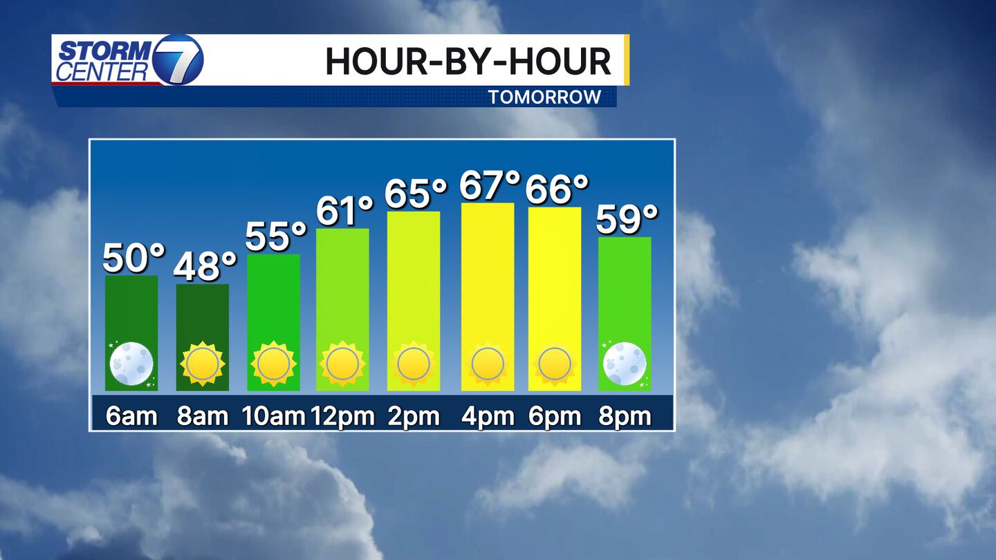
After a chilly start early, Thursday looks to be a nice day with sunshine and temperatures right on par for mid-October! Highs will be in the middle 60s with plentiful sunshine and a light breeze. Friday will bring an increase in cloud cover, but we stay dry with highs in the upper 60s to near 70.
[DOWNLOAD: Free Storm Center 7 Weather app for alerts as news breaks]
Now on to the next system that arrives this weekend! As of this afternoon, the next system is still getting organized across the western United States. As it works east, we will find Saturday as an unusually warm day with highs near 80. It will be breezy as well with gusts exceeding 30 miles per hour at times. This means some leaves are likely to fall.
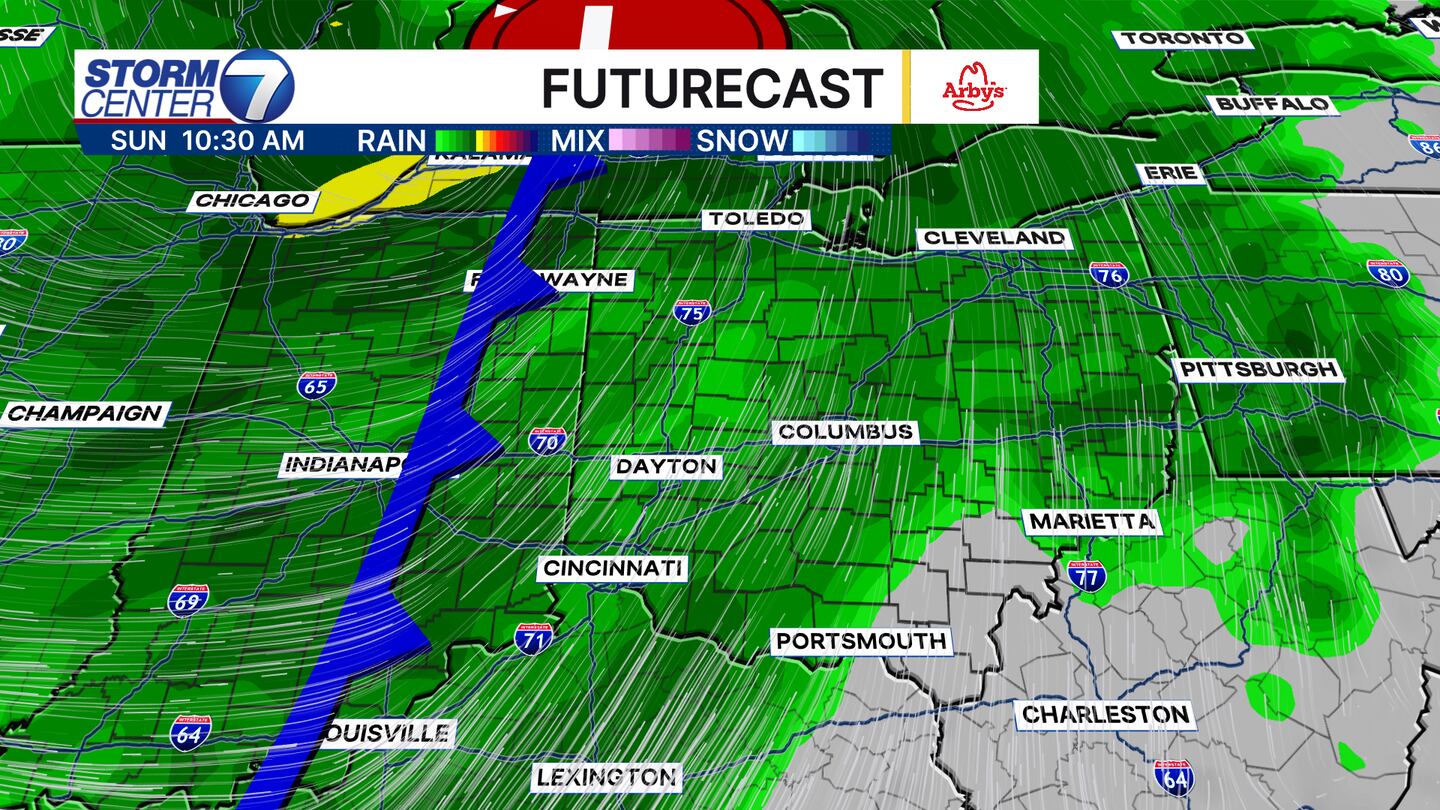
I will say the best day this weekend will be Saturday as we stay dry until after sunset. Late Saturday night we will find rain increasing in coverage and intensity. A few locally heavy downpours are likely and a few rumbles of thunder are possible. No severe weather is expected. The rain will carry into Sunday, so some indoor plans might be a good idea! Highs will be much cooler in the lower 60s. These types of temperature swings are very typical of Fall systems in the Ohio Valley!
[WATCH Storm Center 7 Weather on the following devices]
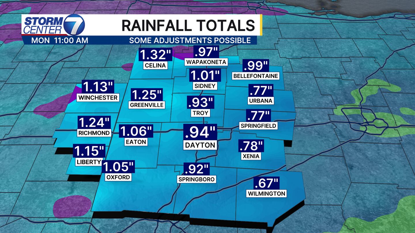
Looking at rainfall totals we do find a solid, soaking rain event a good possibility! I will say it is still early, so a few adjustments are possible. We are not quite in range of the short-term modeling, so we are still relying on medium range guidance that can have a few wobbles in the timing and track. Regardless, we could use the rain, especially across northern counties where Severe to Extreme Drought conditions are ongoing.
We will continue to update that weekend forecast as we draw closer! Be sure to check back for more updates and have that WHIO Weather App handy. Enjoy your evening!


