
DAYTON — Happy Friday, everyone! I hope the end of your week is going well. Weather Specialist Nick Dunn here to break down the forecast for you. We officially had our first freeze in Dayton today as the morning low dropped to 32 degrees! Our typical first freeze is October 25th, so we are right on time.
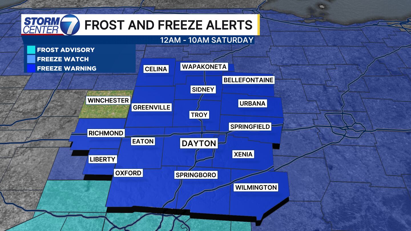
We have another Freeze Warning for tonight as lows will drop to near or below freezing for most areas once again. This goes from Midnight to 10:00 AM Saturday. I would expect a frosty start to the weekend.
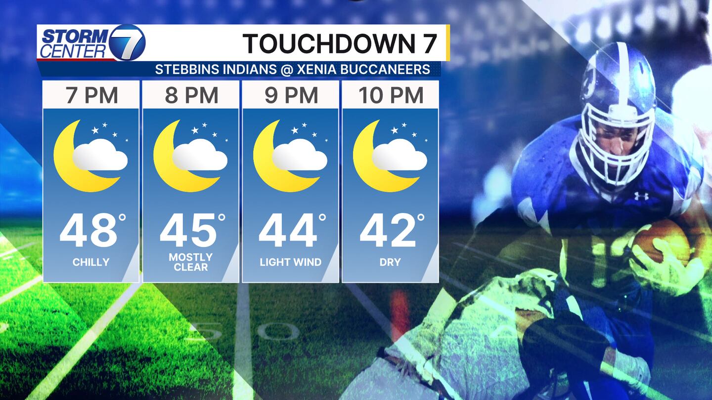
If you are heading out tonight to high school football games dress warm! Temperatures will fall into the upper 40s at kickoff and the low to middle 40s by the end of the games. Those jackets, hand warmers, and blankets will all be a good idea.
[DOWNLOAD: Free Storm Center 7 Weather app for alerts as news breaks]
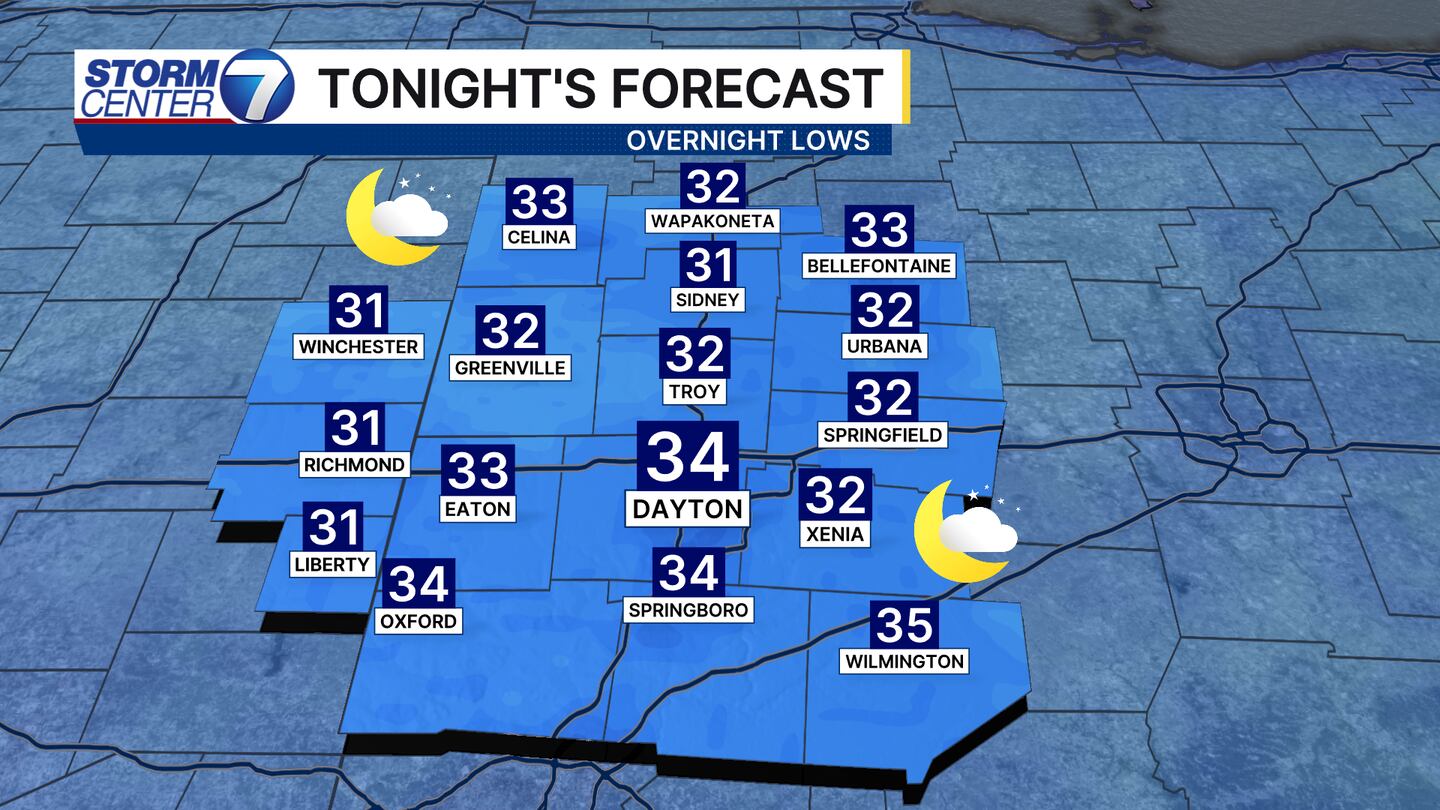
By Saturday morning, we will find lows in the lower 30s for most, with a few mid 30s possible south as a couple clouds trickle in. Overall, another chilly start to your day but not something unusual for this time of year generally speaking.
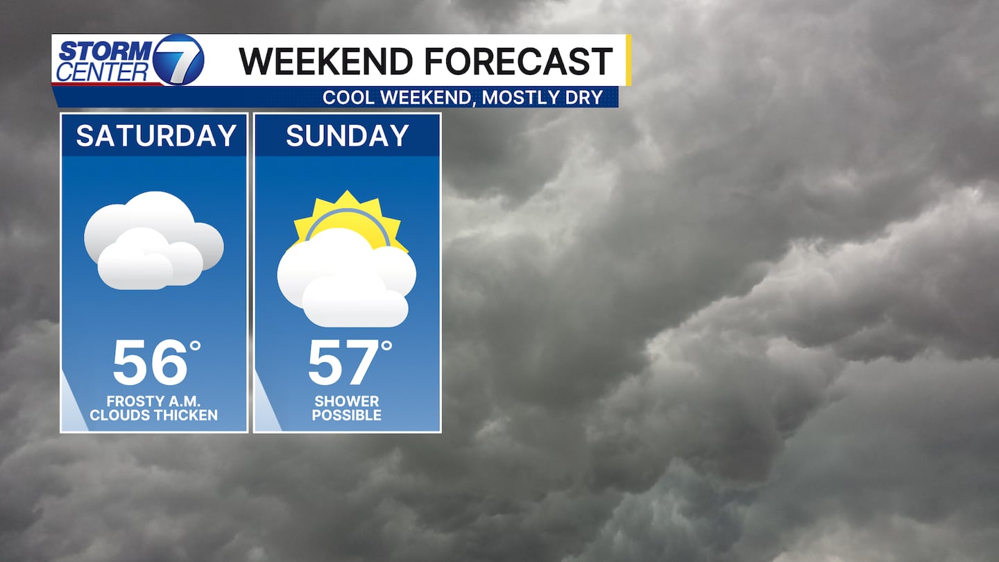
The weekend will certainly feel very Fall-like with highs in the middle to upper 50s. We are likely staying dry, but I am watching Sunday for a sprinkle or light shower to move through. I would not cancel plans, just dress accordingly!
[WATCH Storm Center 7 Weather on the following devices]
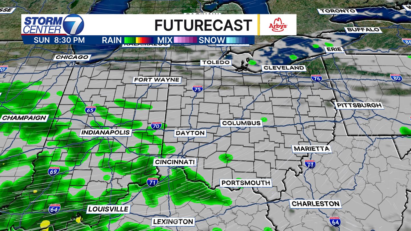
The current run of futurecast shows a couple light showers making their way into the area late in the day towards evening. I am not super confident everyone gets measurable rain from this, but we will watch trends over the weekend.
Also, next week’s rain chances have lowered a bit for now as data shows some drier air for Tuesday and Wednesday. I will maintain a 30% chance of rain, which is a drop from yesterday. It is best to not make drastic changes based off of just one day. So, let’s see what happens over the next few days!
Have a great weekend!


