DAYTON — I’ve continued to check of the computer model runs now that we are trending back into a rainy pattern, and it’s with good news! We’ve had a record number of dry days since August 1. Out of the 50 days from August 1 to September 20, 47 of them came with no rain. That’s a record number of dry days and beats the previous record of 46 that was set back in 2019, 1996, and 1908. Rain is coming back though!
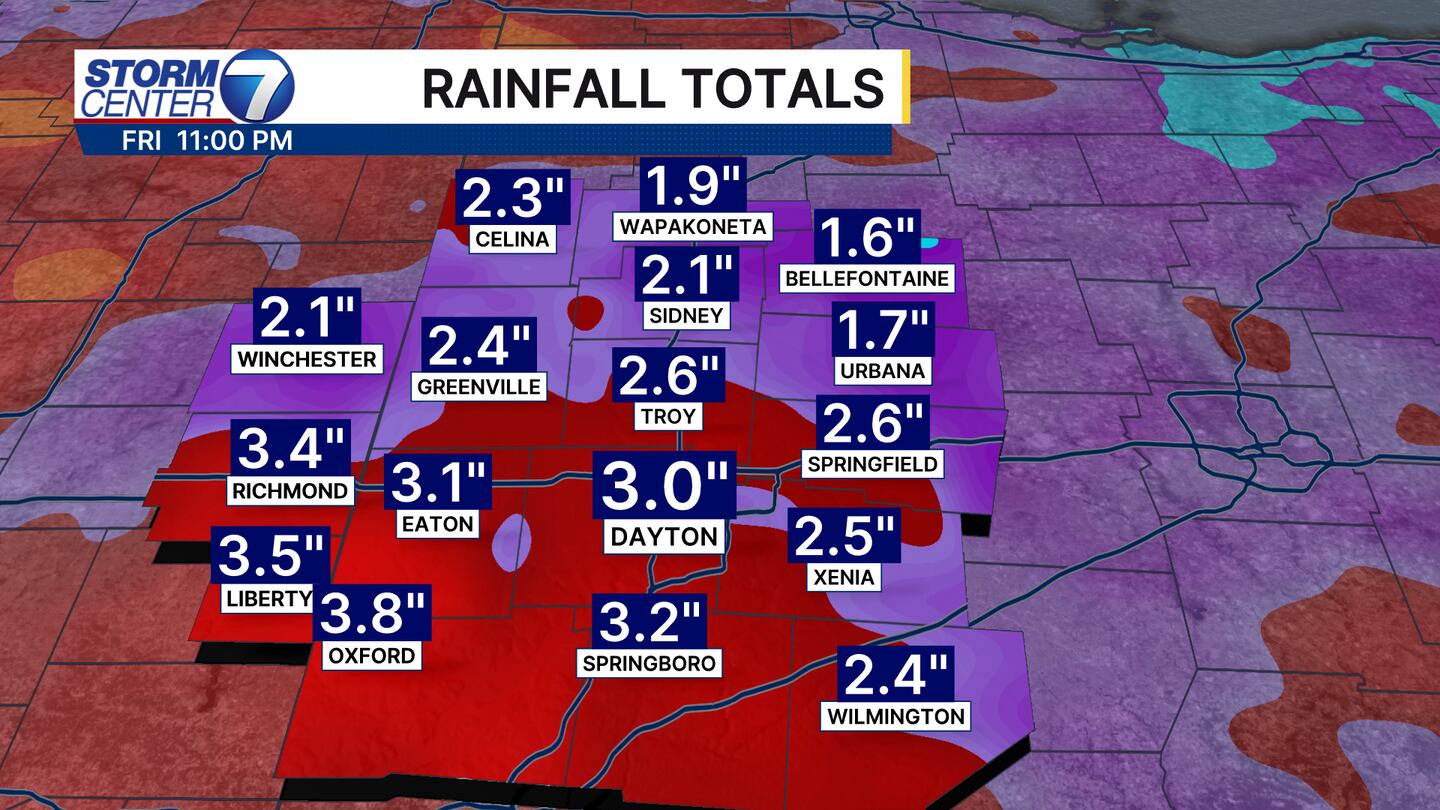
Here’s the latest European model run of rainfall totals for this week as of Sunday morning! It’s showing a lot more areas over 2 inches! The perfect drought buster is rain like this over several days.
[DOWNLOAD: Free Storm Center 7 Weather app for alerts as news breaks]
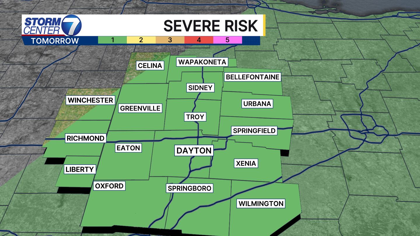
Severe weather does look to be possible though both on Sunday and Monday. We are under a marginal, 1 out of 5, risk of severe weather both days. This means out of the storms we see both days, one or two could come with some gusty, damaging winds. Most areas will just see regular downpours though. Flash flooding still looks to be a low concern, but if a downpour is too heavy the ground won’t be able to absorb it quickly enough.