
DAYTON — As of the 8:00 PM Update this evening from the National Hurricane Center shows Melissa remains a strong Category 4 storm with winds of 145 miles per hour. The minimum pressure is down to 933 millibars, which marks this as an intense storm just looking at that measurement alone.

As we look at infrared satellite, we continue to see a bright core around the center of the storm tonight. This tells us we have deep convection continuing to fester around the eye with cold cloud tops. Melissa also has a “buzzsaw” appearance. This is a non-meteorological term that is used to describe the appearance due to the symmetrical look with a very circular and tightly wound eye. Usually, we see this in strong hurricanes like this.
The current motion is west at just five miles per hour. Why so slow? This is due to a lack of upper level winds to “steer” or drive the storm in a certain direction. Eventually, a trough digging into the southeast United States will help to “pick up” Melissa and move the storm northeast.
[DOWNLOAD: Free Storm Center 7 Weather app for alerts as news breaks]

The latest track shows Melissa still projected to become a Category 5 storm by tomorrow ahead of a landfall early Tuesday. Category 5 winds start at 157 miles per hour, according to the Saffir Simpson Scale.
Melissa will be slow to move away from Jamaica as impacts will likely continue into very late Tuesday night or early Wednesday morning. The mountainous terrain will only exacerbate the flooding and landslide risk. Heavy rain has already fallen over parts of the island.
[WATCH Storm Center 7 Weather on the following devices]
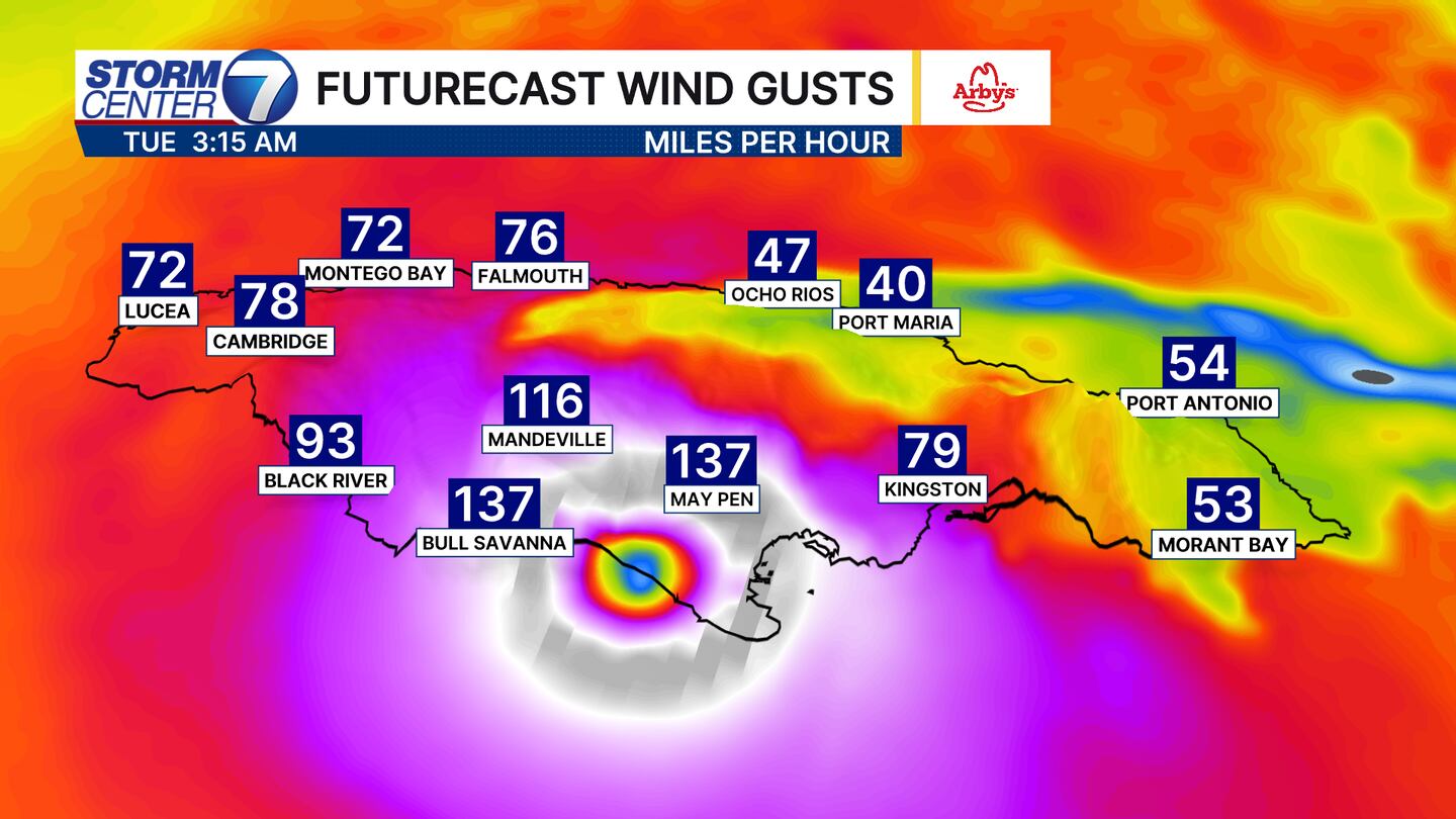
The forecast wind gusts show Category 3 to Category 4 wind speeds being possible early Tuesday morning. You can see how the most intense winds will not extend far away from the center of the storm. Still, hurricane force gusts are likely across the entire island. Any subtle changes in the track given the current motion being so slow could shift where the core of the strongest winds go.
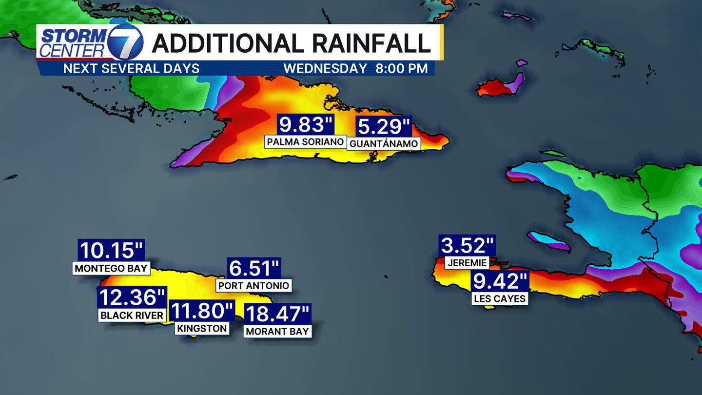
Additional rainfall of 1-2 feet is possible in Jamaica, with 5-10″ or more possible over eastern Cubs and southwestern sections of Haiti through Wednesday.


