
DAYTON — Snow chances are increasing for the upcoming weekend across the Miami Valley. Currently, we are tracking an area of low pressure developing to our southwest over the upcoming 4 to 5 days.
[DOWNLOAD: Free Storm Center 7 Weather app for alerts as news breaks]
There is still quite a bit of uncertainty with the track of the low. Currently, the models push the low farther north. However, that can and will likely still change as we are nearly 6 days out from the event.
[WATCH Storm Center 7 Weather on the following devices]
If the low stays south, the Miami Valley will get little to no snow. If the low takes a northerly track, we can experience moderate snowfall. What if the low goes even farther north? Then we have the potential for ice.
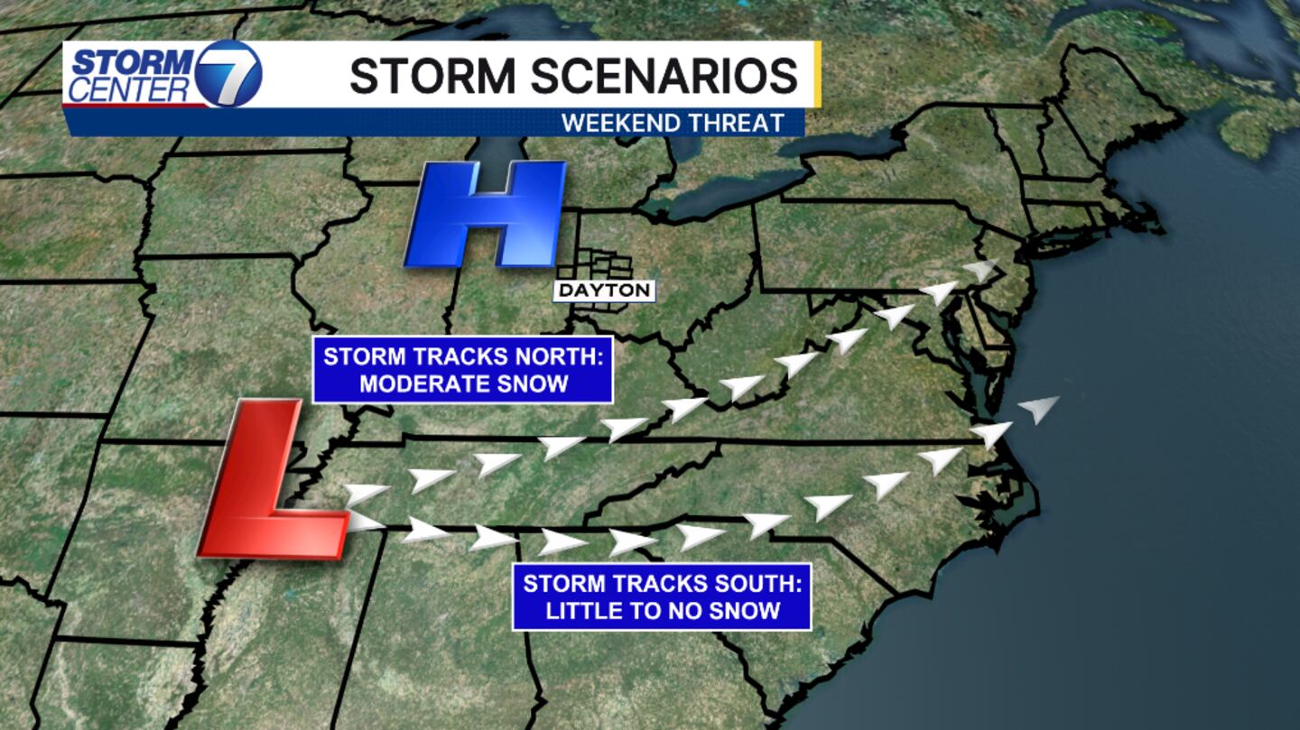
Here’s what we know for certain: temperatures will stay below normal. And at this point, models have trended north, and snow is currently possible. As for totals, we are too far out to determine amounts.
©2026 Cox Media Group


