
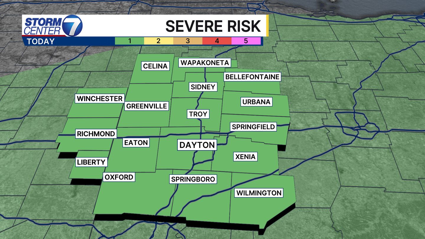
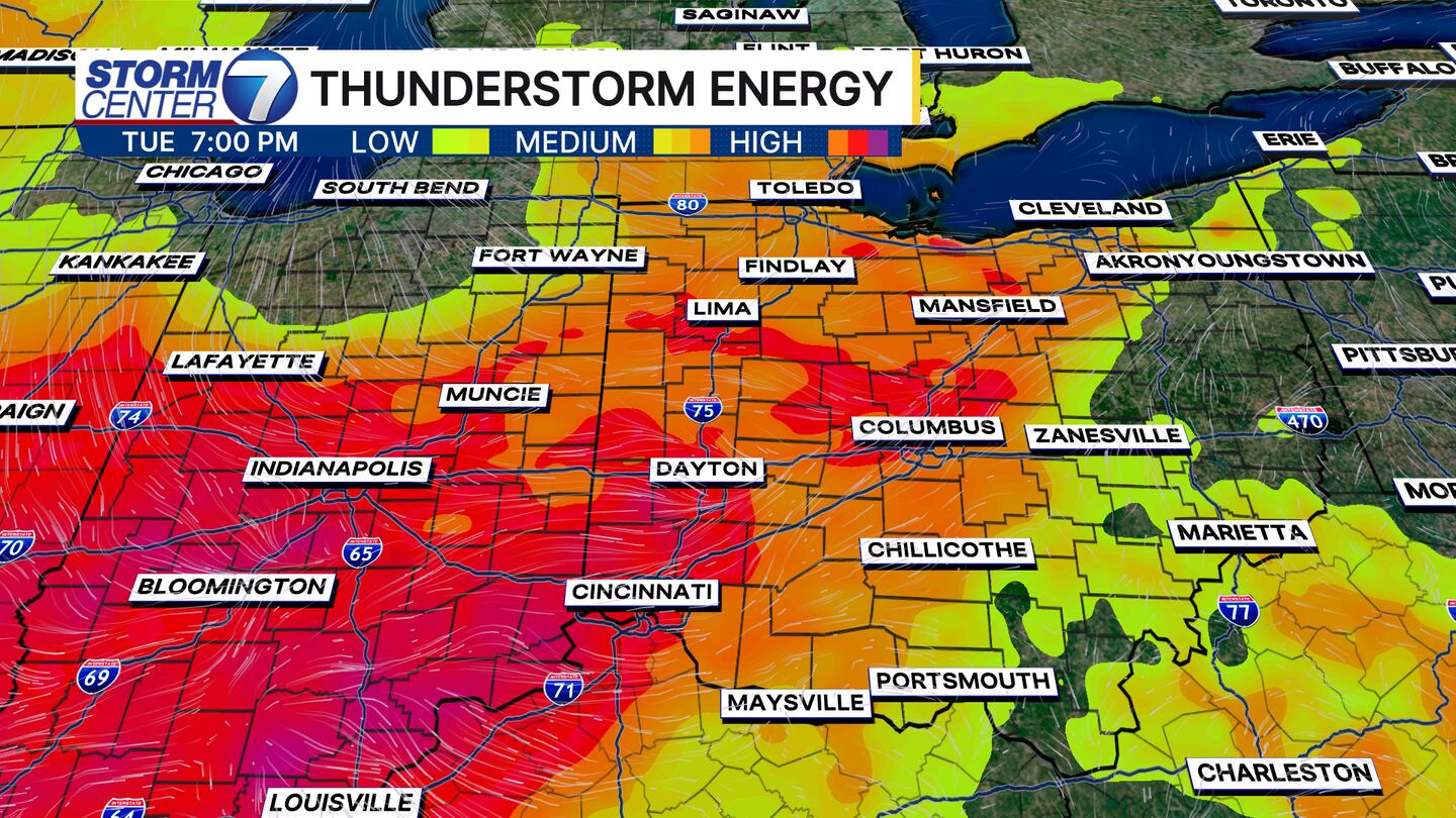
DAYTON — Tuesday does have severe weather potential for the entire Miami Valley. The risk from the Storm Prediction Center is a 1 out of 5, which means out of the storms we see today, one or two of them could become severe producing damaging straight-line winds. Most areas will not see severe storms.
[DOWNLOAD: Free WHIO-TV News app for alerts as news breaks],
TRENDING STORIES:
- Brio abruptly closes area’s only location; Neighbors worried for shopping center’s future
- Local district forced to make adjustments to accommodate rising enrollment after failed bond issue
- Local school supply store announces upcoming closure, offers discounts
The other issue I’m tracking is the possibility of heavy rain and isolated flash flooding. The ground has been dry for the past several days, and when that heavy rain falls, the ground can’t absorb the rain very effectively. This means poor drainage areas may see some minor flooding.
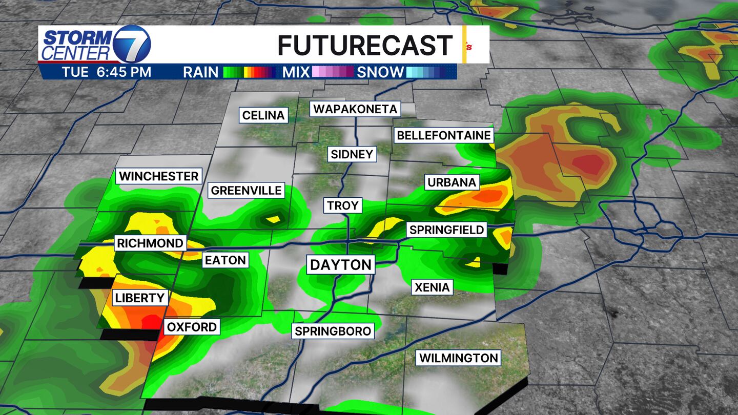
The timing of these storms looks to be during the heat of the afternoon, between about 4 pm and 10 pm today. That line will track from the northwest of Dayton to the southeast of our viewing area during that timeframe.
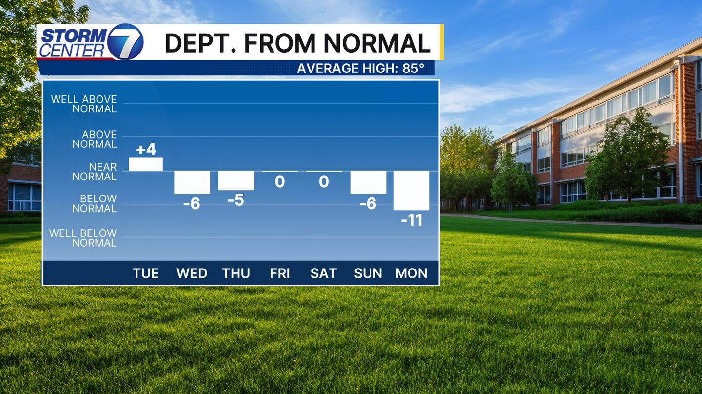
Then we get the payoff! Temperatures are likely only in the 70s and low 80s for the rest of the work week. Another moisture-starved cold front arrives over the weekend, which drops temperatures far below average into the next week.
[SIGN UP: WHIO-TV Daily Headlines Newsletter]
©2025 Cox Media Group


