
MIAMI VALLEY — High heat and feels like temperatures are sparking a complex of thunderstorms arriving in the Miami Valley early Sunday morning, according to Storm Center 7 Meteorologist Ryan Marando.
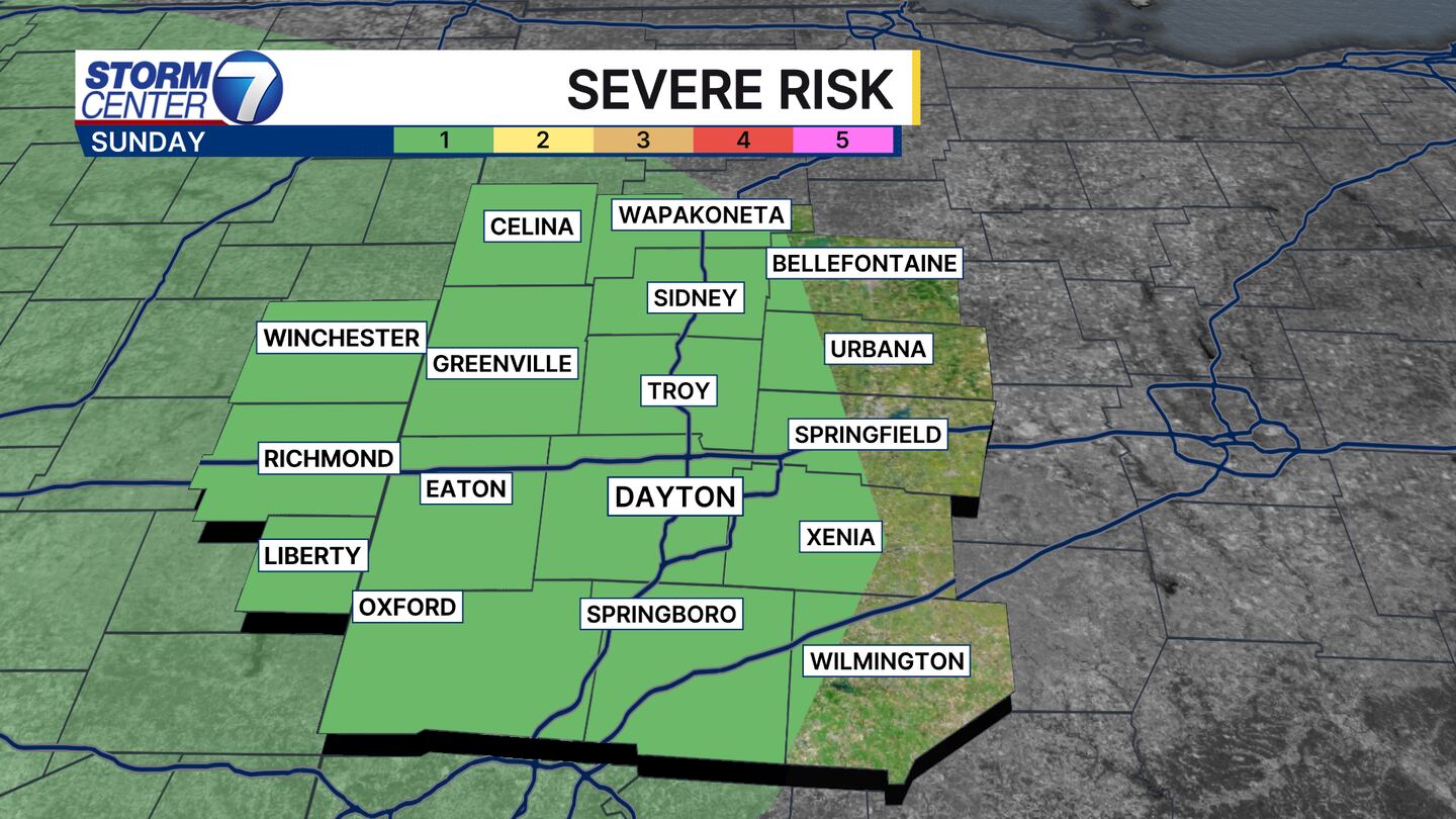
There is a low severe weather risk for most of our area.
Areas highlighted in green are under a 1 out of 5, Marginal, severe weather risk, meaning one or two of the storms could produce damaging straight-line wind gusts.
[DOWNLOAD: Free WHIO-TV News app for alerts as news breaks]
The timing of these storms looks to move through from the northwest at 4 a.m., moving southeast until around 9 a.m.
Many areas will just see regular thunderstorms and heavy rain, but one or two could be on the stronger side.

TRENDING STORIES:
- Police departments investigating several daytime burglaries in Montgomery County
- Man found guilty of shooting, killing security guard at local nightclub
- Man gets over 100 years in prison for child pornography, rape conviction
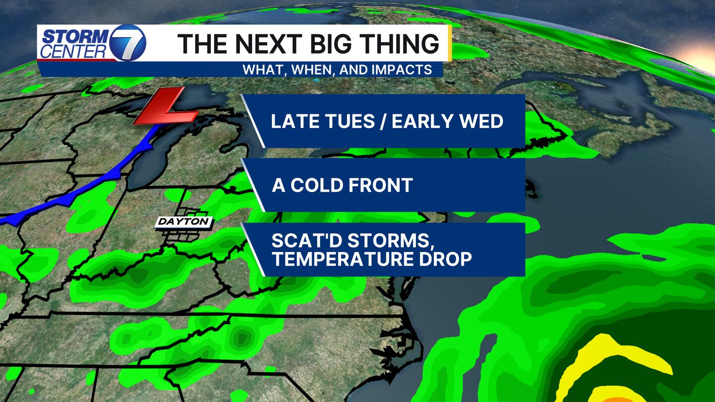
These storms don’t cool us off too much, so we need to wait until Tuesday night into Wednesday when a cold front moves in, according to Marando.
This will give us scattered storm chances mid-week but make temperatures more comfortable for Wednesday afternoon, Thursday, and Friday.
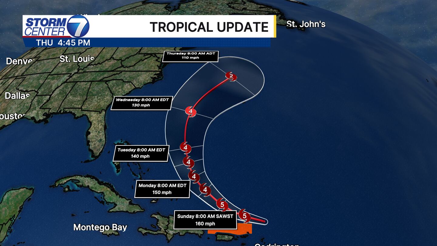
That front is helping keep Category 5 Hurricane Erin, as of Saturday afternoon, out to sea.
We will not see impacts from this storm here in the Miami Valley.
The biggest impacts on the United States look to be rough seas and high surf along the East Coast, Marando said.
[SIGN UP: WHIO-TV Daily Headlines Newsletter]
©2025 Cox Media Group


