
DAYTON — Let’s be real.
It’s HOT outside. It truly is a “typical” summer here in the Miami Valley.
We’ve officially experienced 4 heat waves-- three 90 plus degree days three days in a row, for the season thus far.
And, we have the potential to do it again this weekend.
Last year we experienced 4 heat waves and the last in the month of September.
On average the latest 90 degree day at the Dayton International Airport is September 4th. The latest on record, October 15th.
Let’s hope that doesn’t happen...
So far for the season Dayton International has accumulated seventeen 90 degree days. And with this weekends heat, we will be adding to this number.
Last year we managed to grab onto twenty-five 90 degree days.
Cooler air is in the forecast.
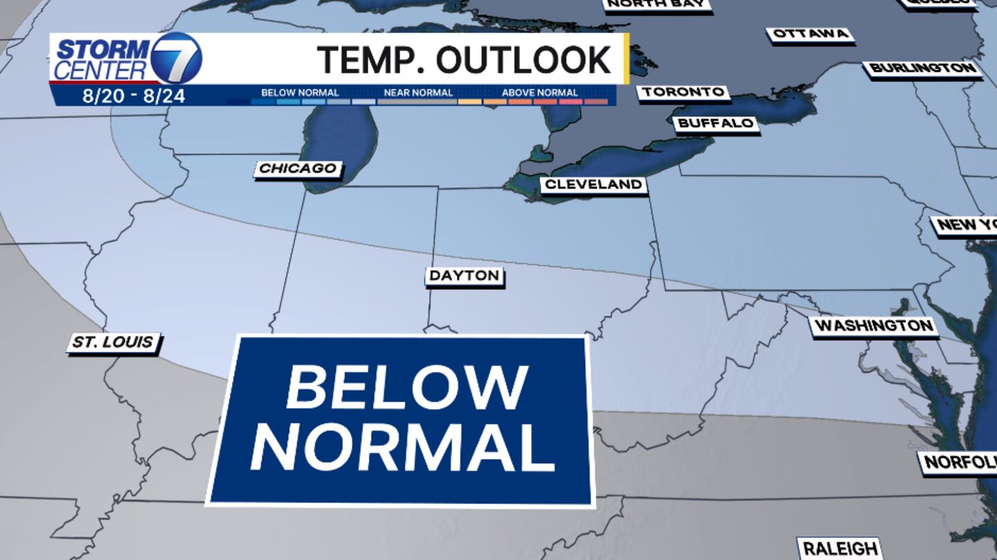
The Climate Prediction Center gives us a higher probability of being below normal starting next week.
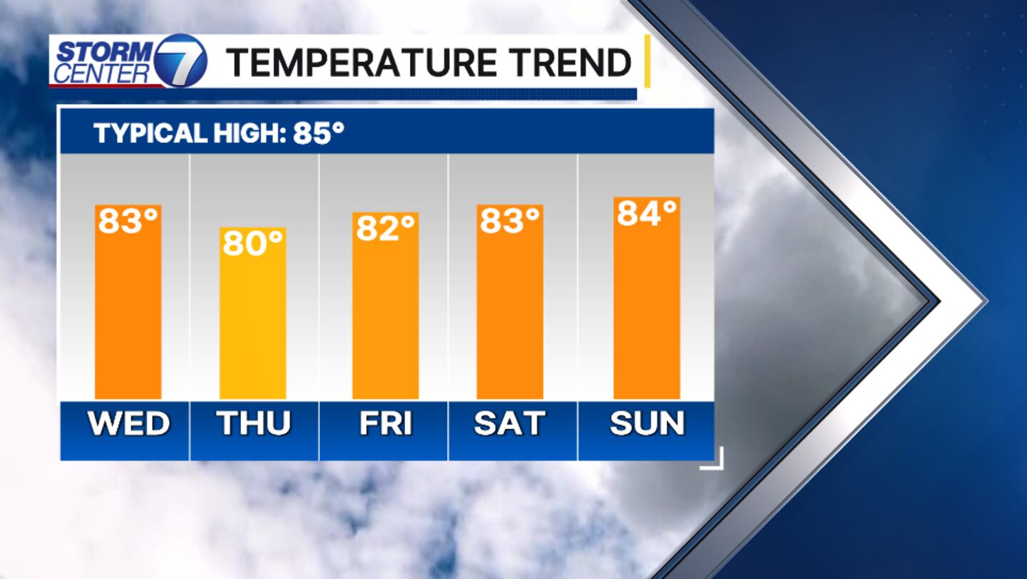
An approaching cold front will arrive Tuesday and into Wednesday of next week. There’s quite a bit of uncertainty with the timing of this system and how much rain we’ll receive, but what we can say is that there will be rain and we will cool down.
At this point in time temperatures look to fall into the upper 70s and low 80s starting Wednesday. Humidity levels will be much lower as well. So this will be a drier air mass.
©2025 Cox Media Group


