
DAYTON — Hello, everyone! Weather Specialist Nick Dunn here on this Sunday evening to break down what we are watching this week with the forecast. The weekend was picture perfect with both days featuring highs in the 70s and felt very much like mid-October should!
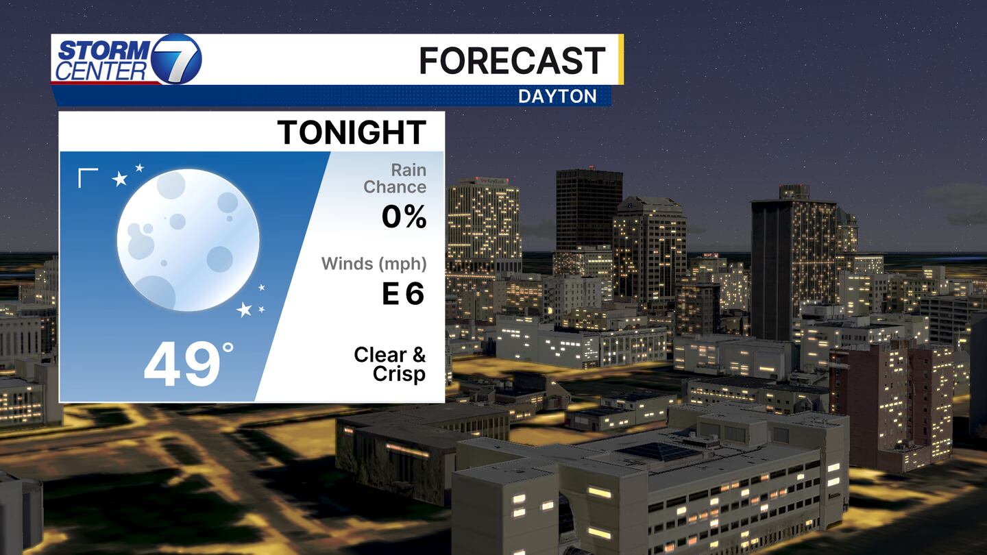
A clear and crisp night is in store for everyone across the Miami valley tonight with lows in the upper 40s in most cases. A few clouds are around this evening, but those should fade away after sunset. The clouds that are out there are from a coastal low to our east, and counterclockwise flow around that storm allows for clouds to move east to west. Very cool to see!
[DOWNLOAD: Free Storm Center 7 Weather app for alerts as news breaks]

The kids may want a light jacket early on at the bus stop, but otherwise we are in good shape with highs reaching the lower 70s in the afternoon. Just make sure the kids bring that jacket home as cool mornings are with us all week!
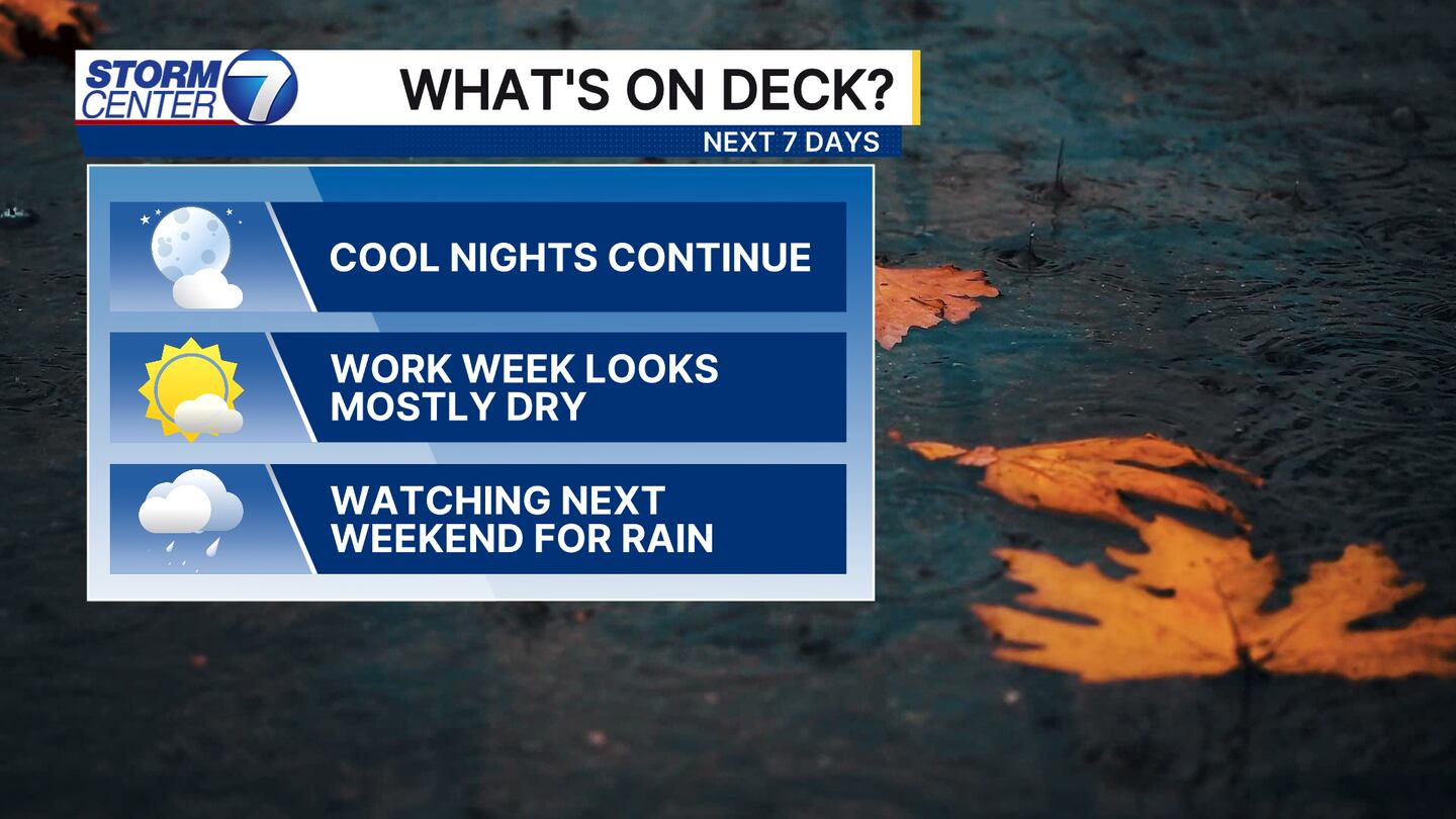
The work week itself is looking mostly dry. We will not have any higher impact weather until next weekend when rain chances increase. In between that, a mostly dry front slides through here on Tuesday night. That might spark a sprinkle or two here, but we are likely dry.
[WATCH Storm Center 7 Weather on the following devices]
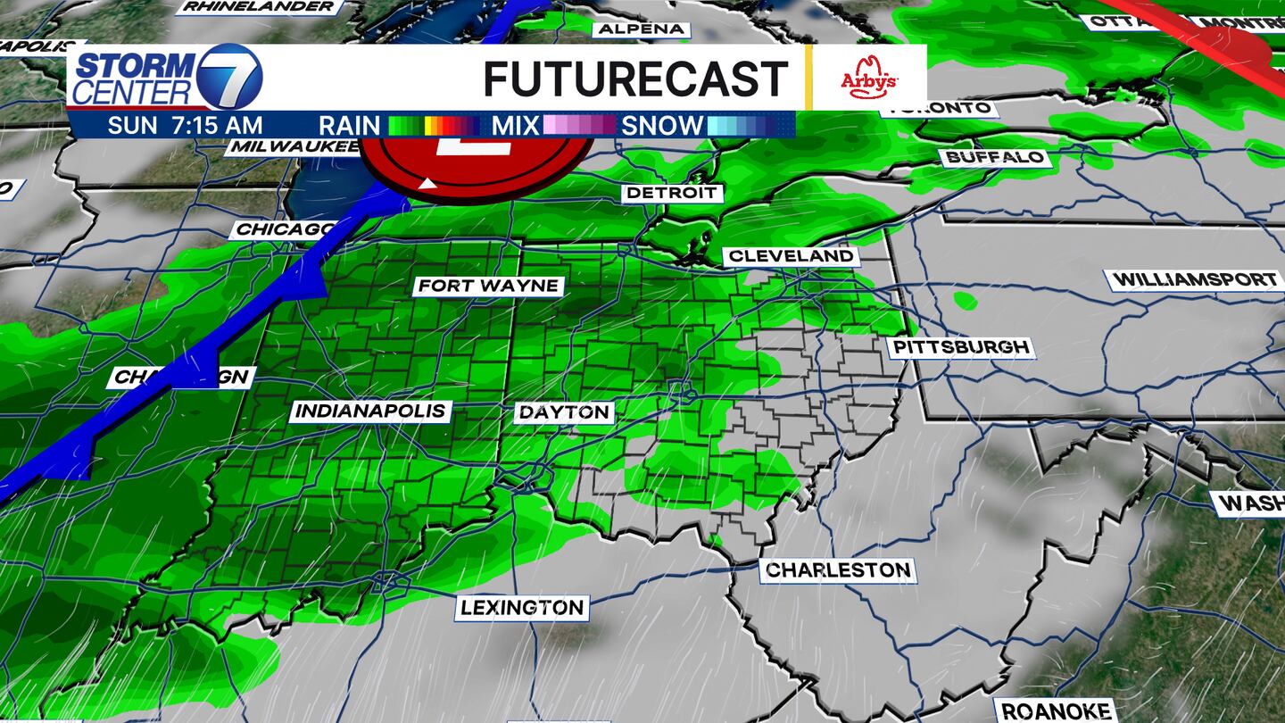
As we look ahead, current guidance shows a cold front moving closer to us by late Saturday and Sunday. This should bring rain into the Miami Valley. Of course, with this being 6-7 days out we will see the timing and track of the system fluctuate a bit. Be sure to stay up to date with us through the week as we watch how things trend for us! Have a great week!


