
DAYTON — Good evening, everyone! Meteorologist Nick Dunn here with you on this Saturday night. It was awesome to see some sunshine out there today after a long period of gloomy weather!

Around 100 hours in a row from early Tuesday to late this morning saw an overcast or mostly cloudy sky condition in Dayton! That is quite an extended stretch, but not too uncommon this time of year.
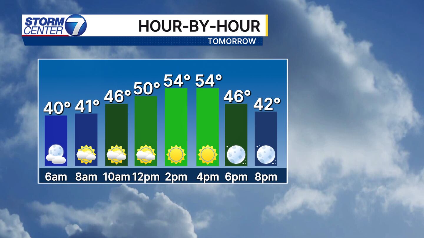
Sunday will feature a slightly milder day with highs a bit above normal for late November! After some morning clouds at times we will find sunshine in the afternoon. Get out and enjoy it!
[DOWNLOAD: Free Storm Center 7 Weather app for alerts as news breaks]

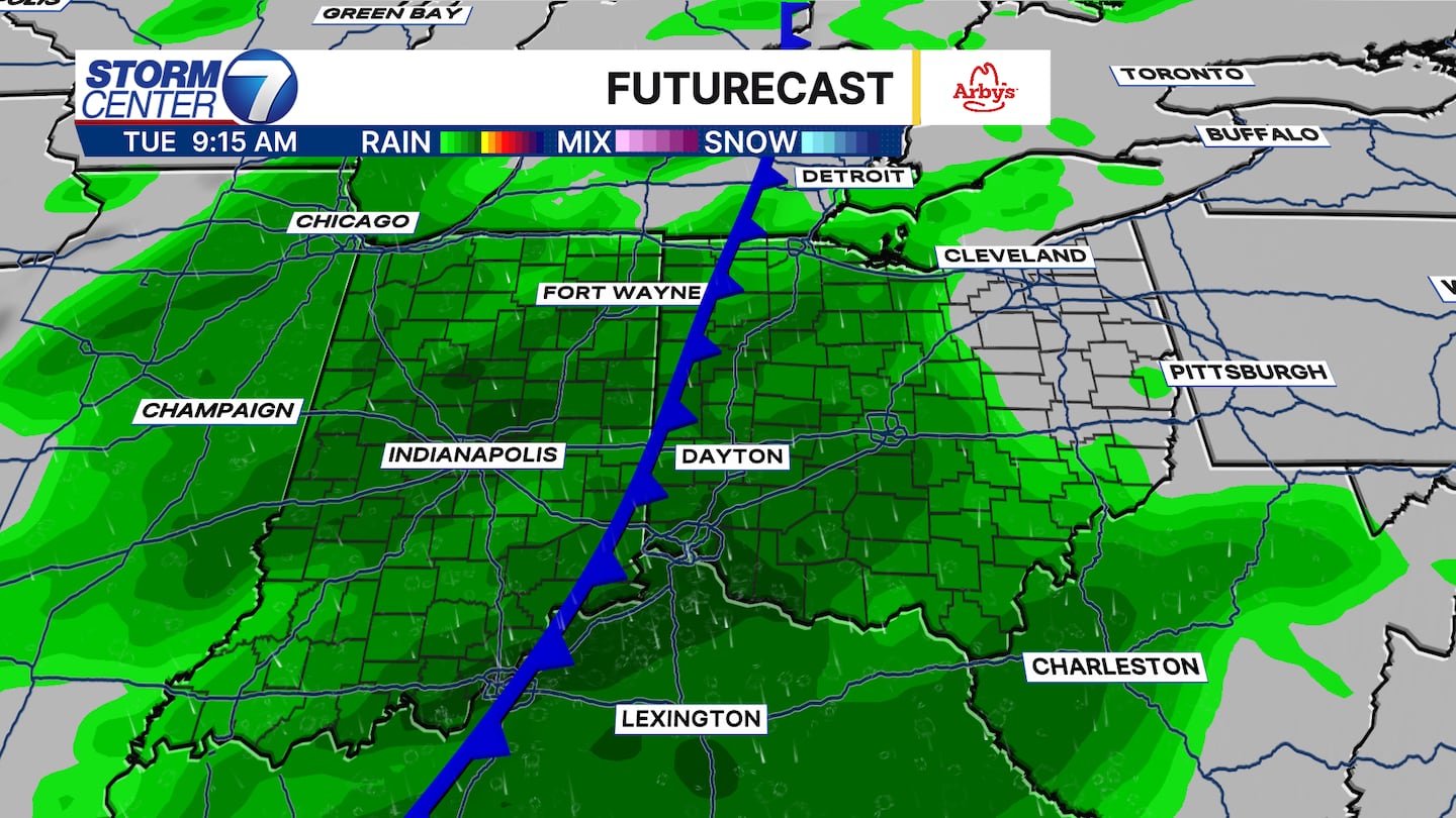
The mild weather will continue into the start of the shortened work week with highs nearly ten degrees above average by Tuesday. The catch? Our next big system comes in to bring rainy conditions for much of the day. This could slow travel a bit for those driving during the day with steady rain showers.
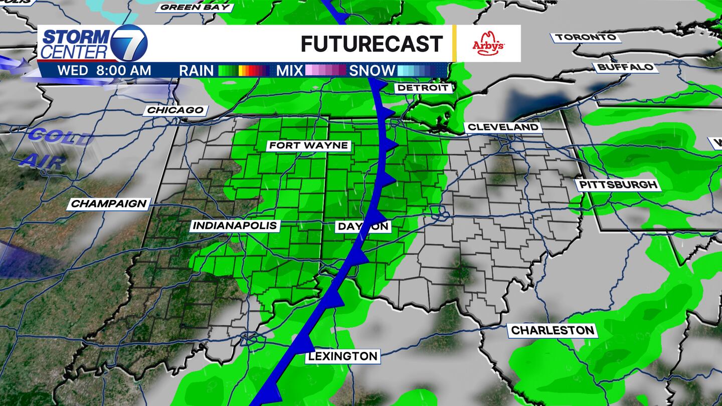
This rain will clear out by late Tuesday night. However, a secondary front will swing in Wednesday morning to bring a few showers and falling temperatures. The true high will likely occur at midnight, but afternoon highs should be in the lower to middle 40s on Wednesday.
[WATCH Storm Center 7 Weather on the following devices]
After Wednesday we find ourselves in a cold snap for a few days with highs in the 30s and lows in the 20s. Overall, things look dry locally. If you plan to travel into the snowbelts of western Michigan, northeast Ohio, or western New York you will likely navigate some lake-effect snow!

I will keep you updated on the travel forecast over the coming days! Enjoy the rest of your weekend!


