
DAYTON — An area of low pressure is setting up to our west, and attached to it is a cold front.
Ahead of the cold front, our atmosphere becomes unstable.
A few severe weather parameters are lining up.
Wind shear, wind direction, and speed change with height in our atmosphere, a lifting mechanism, which is the cold front itself and the low-level jet that is described as a river of fast moving area above our heads.
This sets up late in the evening on Thursday.
If we grab onto a lot of sunshine, our atmosphere is primed, and the warmth and moisture in the air will help increase our severe weather threats.
[DOWNLOAD: Free Storm Center 7 Weather app for alerts as news breaks]
The timing looks to be after 6 p.m. on Thursday and lasting through midnight.
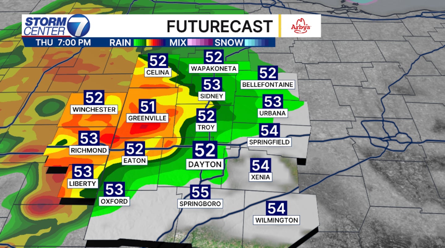
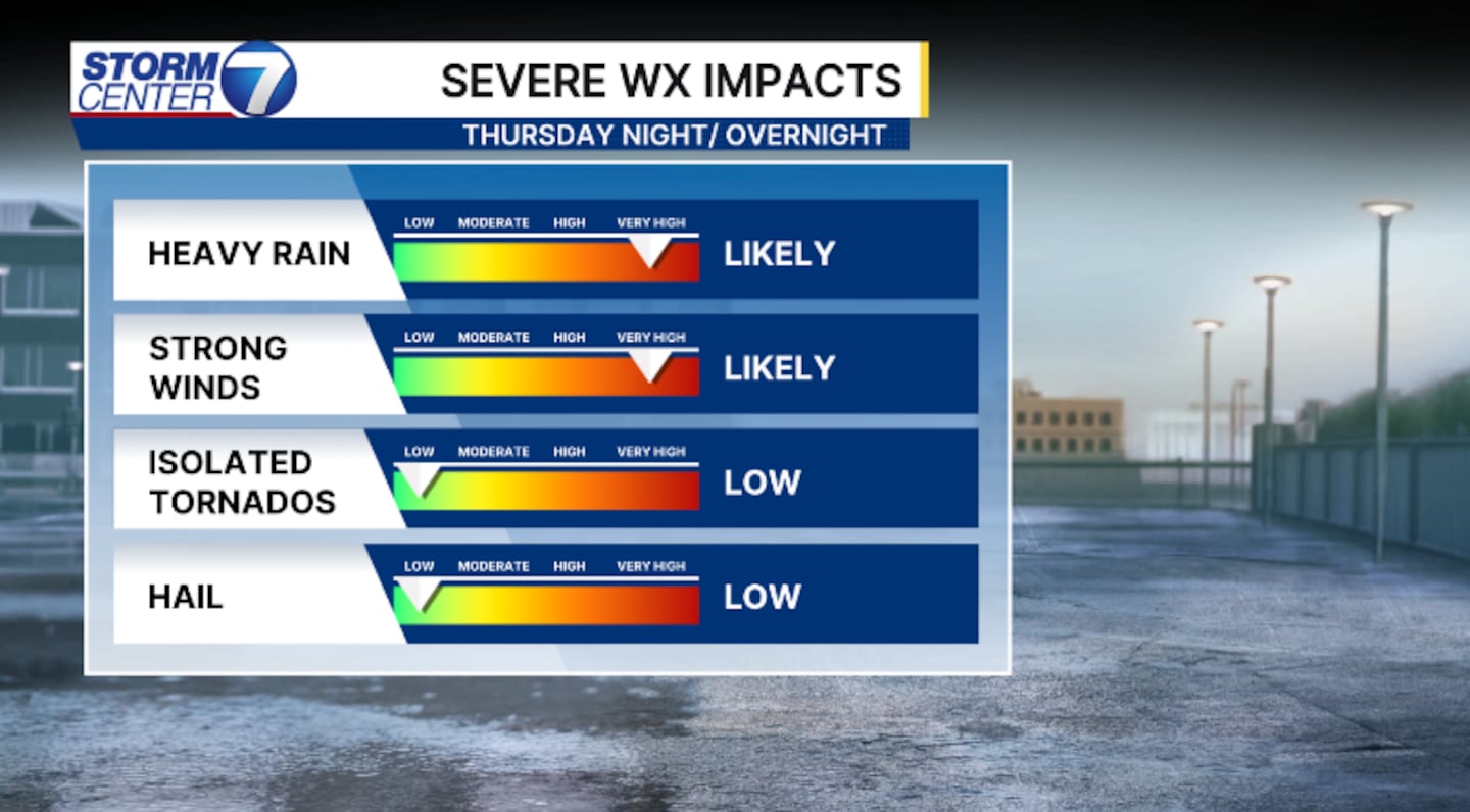
Our greatest threats are heavy rain and strong, damaging winds.
However, isolated tornadoes are possible.
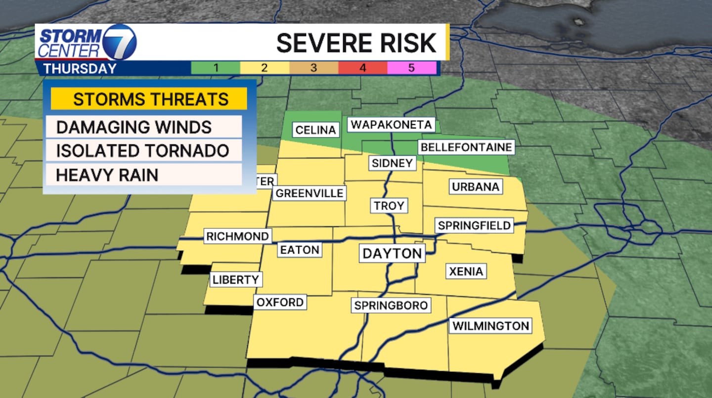
The Storm Prediction Center has the Miami Valley under a level two of five, meaning there is a slight risk of severe weather.
This is more of an isolated threat, where one or two storms become severe.
[WATCH Storm Center 7 Weather on the following devices]
Be weather aware. Know where your safe place is.
Don’t forget to download the WHIO weather app for alerts, live radar, and FutureCast.
©2026 Cox Media Group


