DAYTON — Good evening, everyone! Meteorologist Nick Dunn here on this Saturday night with an update on the forecast!
So far, things are largely playing out as expected with one wave of snow impacting our northern counties. Some of you in Mercer and Auglaize Counties saw 1-2″ of snow and conditions getting slick quickly.
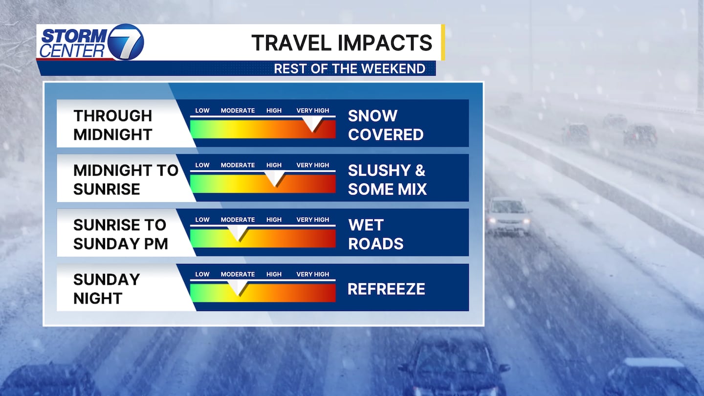
Between 8PM and Midnight I do expect snow to cause slick conditions with gusty winds over 30+ MPH at times. As we work beyond Midnight, we should see some rain or mixed precipitation to make things slushy as temperatures rise. Sunday morning should largely feature wet roads as some melting will have taken place. A slushy spot or two is possible. Then, as we get cold again into Sunday night a patch or two of refreeze is possible.
[DOWNLOAD: Free Storm Center 7 Weather app for alerts as news breaks]
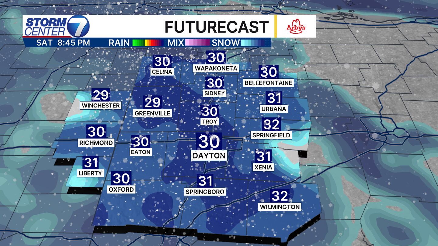
Futurecast shows show becoming much more widespread, and briefly heavy at times, past 8PM this evening. With temperatures below freezing we can find roads going from dry to snow-covered quickly. This will be true on those untreated surfaces in particular, along with bridges and overpasses. The heaviest snow should end around Midnight or shortly after.
Precipitation will continue into the early morning hours. However, with things warming up a bit we should see improvements to travel conditions into Sunday morning. Winds remain pretty strong as well, and that should help us dry most roads by Sunday afternoon!
[WATCH Storm Center 7 Weather on the following devices]
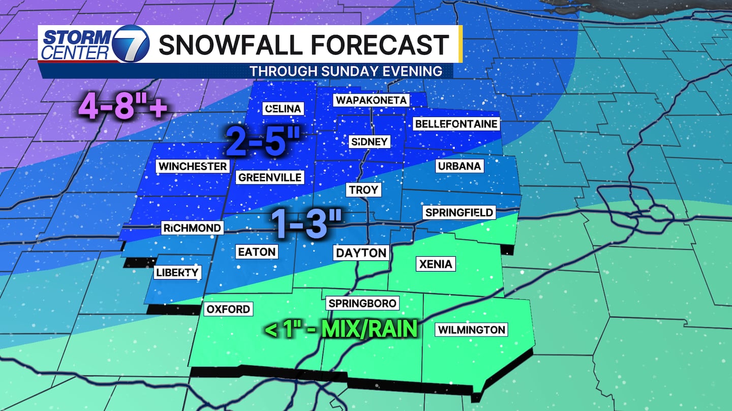
The snowfall forecast remains largely unchanged. The gradient between lighter snow and slightly more impactful snow is pretty tight now. So, we will have to watch temperatures closely to see if anyone gets more or less than what is shown here. The best chance of 5″ is up in Mercer and Auglaize Counties where that first wave of snow was a good one!
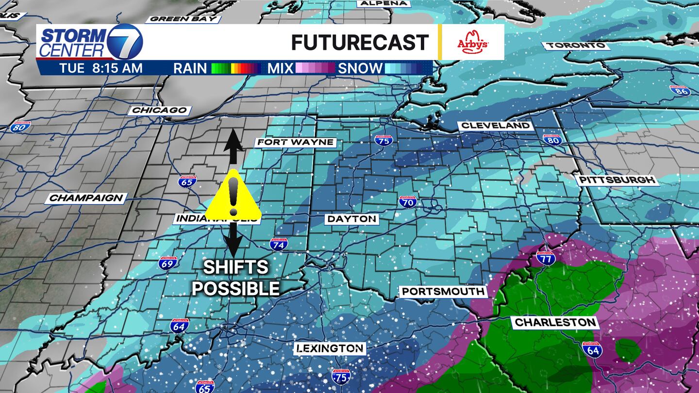
The pattern stays active! Another system is likely on Tuesday. Some shifts in the track are possible. As of now, we look to stay all snow with more accumulations possible. But, let’s get through tonight before focusing on the next one!
Beyond Tuesday I am watching yet another system that looks weaker as of now. That would arrive late Friday with a period of rain or snow. But, we have to take things one storm at a time. Buckle up! The cold is also here to stick around.


