
DAYTON — An area of low pressure is developing to our west and will bring rain and storm chances througout the latter part of the week and into the weekend. This won’t be a washout event, but does increase rain chances each day starting Thursday and lingering into Monday of next week.
[DOWNLOAD: Free Storm Center 7 Weather app for alerts as news breaks]
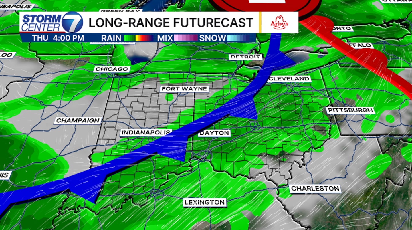
There are still some uncertainties with the track of the low which will play a role in the heaviest rain and where it sets up. Currently the showers and storms will be scattered throughout the early morning hours Thursday. A better chance for storms will arrive late Thursday afternoon and evening with the approaching cold front.
The front will move through the Valley, but will attempt to lift back north and stall leaving the Valley with rain chances through Friday and Saturday. At this time, the heaviest of the rain will hold along the stalled boundary near the Ohio River.
Sunday through Monday will be more of a scattered storm chance with the heat ramping back up. High temperatures will once again climb above normal. High temepratures have the potential to hit 90 plus degrees into next week.
[WATCH Storm Center 7 Weather on the following devices]
As for rain and storm chances, the severe weather threats are low at this time. However, strong gusty winds can’t be ruled out. Wind gusts over 60 MPH are possible with a few storms Thursday.
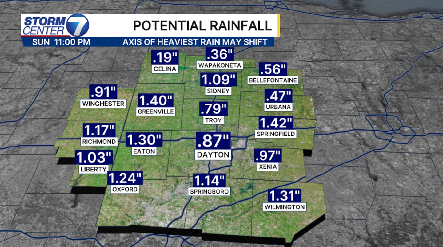
Flooding is also a possibility with an additional 2 inches of rain through Sunday. Of course, stronger storms will bring heavier rain rates and can also pose the threat of flash flooding.
©2026 Cox Media Group


