
DAYTON — Happy Sunday to you! Weather Specialist Nick Dunn here on this sunny morning to show the latest forecast trends for today and the upcoming rain chances. We expect a very warm end to the weekend with highs in the middle 80s.

A southerly breeze will help us stay warm this afternoon with high pressure off to our east. No threat for rain today, which is great for outdoor plans!
[DOWNLOAD: Free Storm Center 7 Weather app for alerts as news breaks]
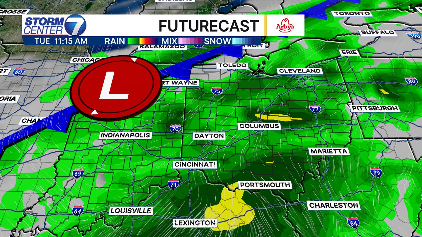
A cold front marches toward us to kick off the work week. We will find a bit of a muggy day on Monday that may spark a couple late-day showers or storms. However, better rain chances are still on tap for Tuesday. A few heavy downpours are possible, but severe storms are not expected.
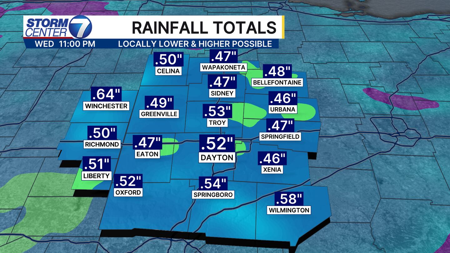
Rainfall totals still look to average around 0.50″ for most. Guidance this morning has trended a bit drier, so I will watch to see if this is a trend or perhaps the models having an “off” run. Yesterday’s guidance showed a few pockets of over 1 inch of rain, but as of now I think 0.50″ is a safe forecast.
[WATCH Storm Center 7 Weather on the following devices]

Behind this front we are drier and cooler for Wednesday and Thursday. In fact, Thursday and Friday mornings should feature morning lows in the 40s! That will be a nice change of pace! Have a great Sunday!


