DAYTON — Good evening to all of you on this Saturday! Meteorologist Nick Dunn here with you on what has been an abnormally warm day here in the Miami Valley! The warmth is not booking an extra day to stick around though.

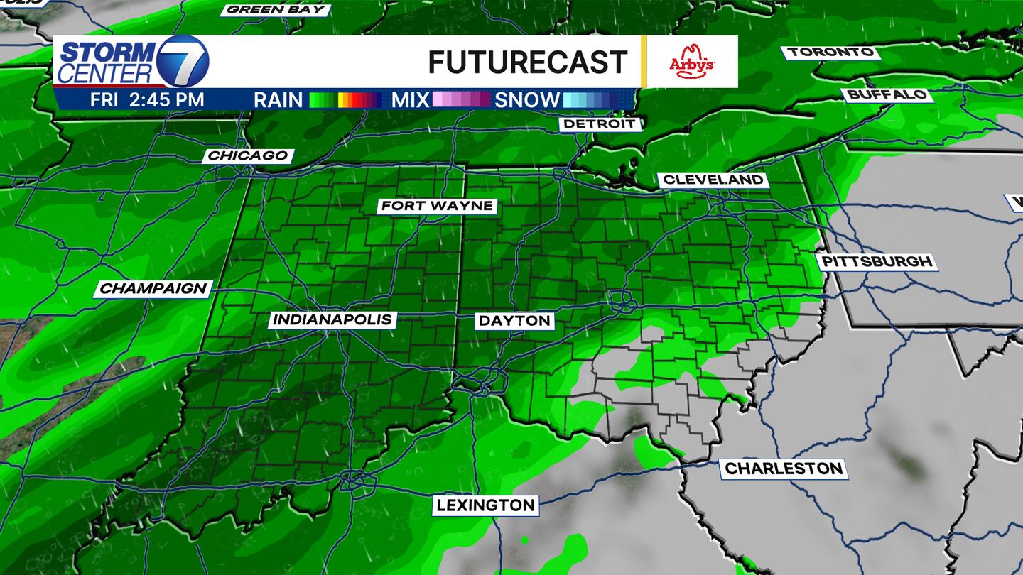
A cold front sliding through may spark a few showers this evening as it crosses through. The rain coverage looks pretty spotty, but the wind will stay elevated tonight. Instead of a southwest wind, we will see more of a west to northwest wind by Sunday morning.
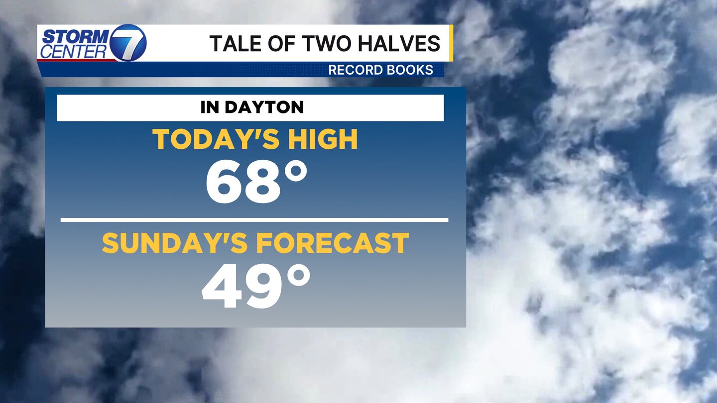
While many of you maybe opened the windows or spent time outside today, Sunday promises a much cooler day. Highs will only be in the upper 40s in the afternoon with sunshine and breezy conditions.
[DOWNLOAD: Free Storm Center 7 Weather app for alerts as news breaks]
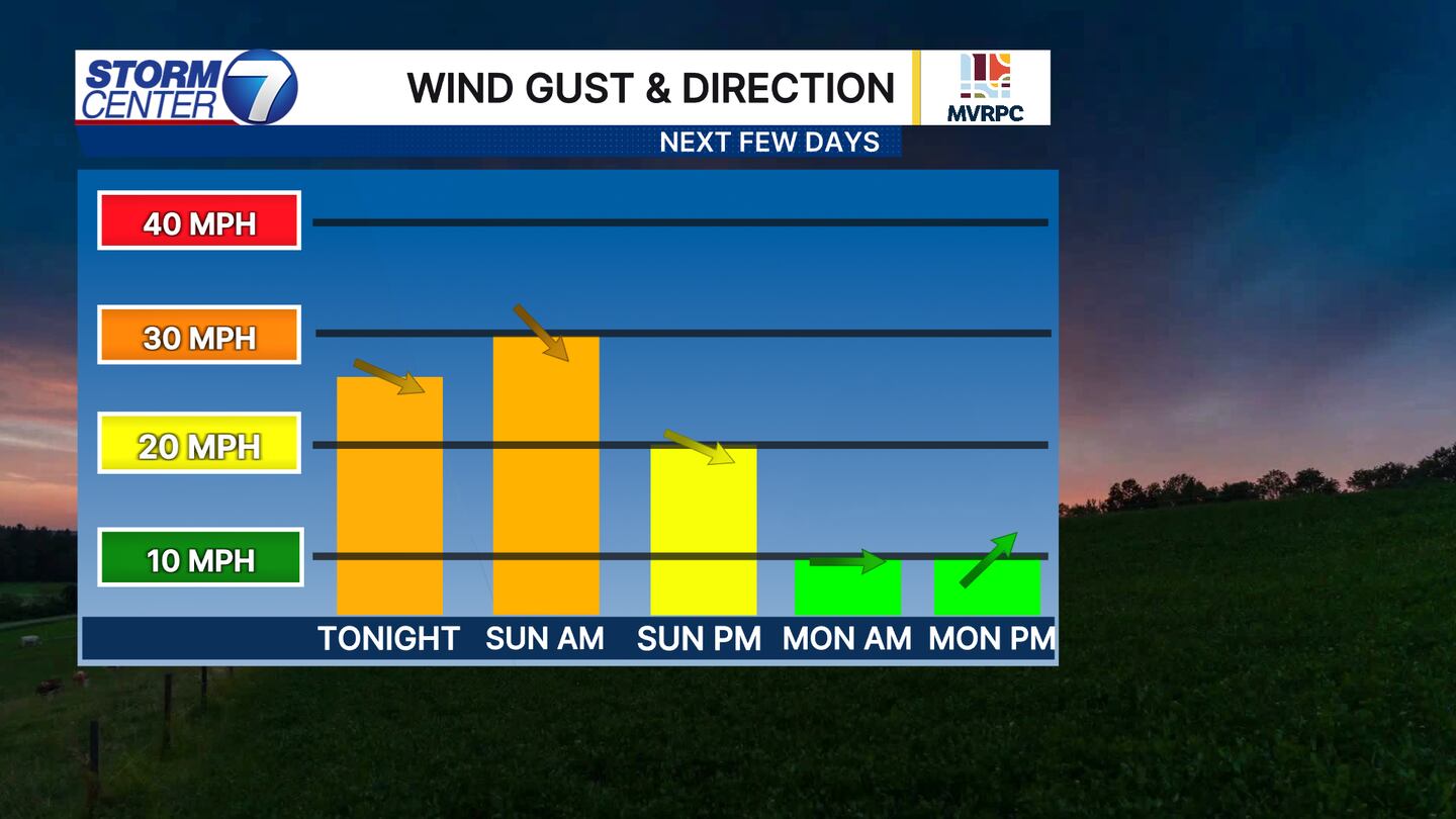
The wind will stay elevated through tonight into Sunday with gusts of 25-30 miles per hour continuing through much of the day. Winds will subside a bit by Sunday night and even more into Monday morning.
[WATCH Storm Center 7 Weather on the following devices]
We are watching a series of systems into next week. The first system arrives late Monday night into Tuesday morning with rain showers. Temperatures are close to being cold enough for a snowflake or two to mix in initially, but the atmospheric profiles suggest we warm enough to be mostly rain.
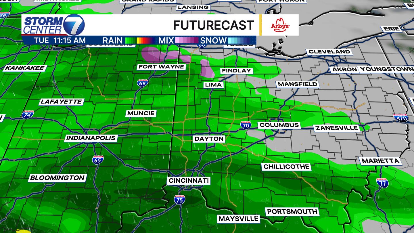
While that rain will come with a chill as highs climb into the lower 40s, the next systems that follow will feature milder temperatures in the 50s and perhaps nearing 60 by Friday. We still have plenty of time to iron out some model differences, but late next week looks to be the next stronger system to impact us.