
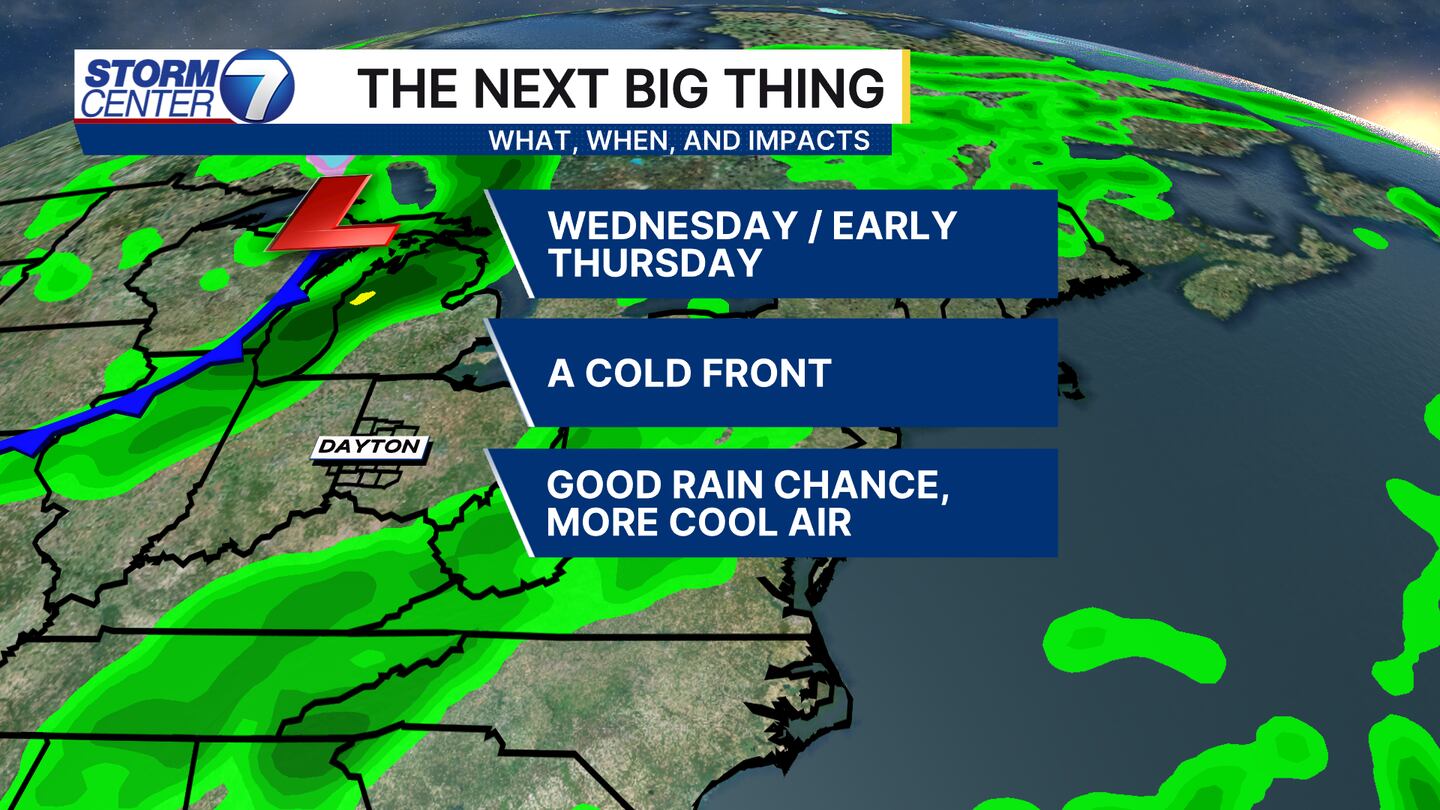
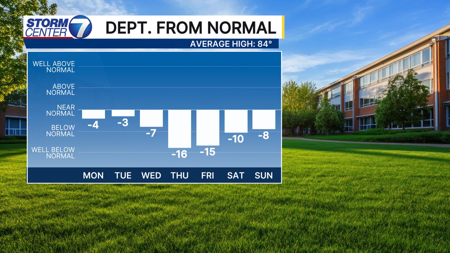
DAYTON — Hey, it’s Meteorologist Ryan Marando. I hope you’re having a great Labor Day weekend! Temperatures continue to stay well below average, and it’s only being reinforced by our next weather system. Another cold front will be arriving on Wednesday afternoon and into Thursday morning. This does look to give most of us the healthy rain that we need!
Temperatures will fall once again behind this. Well below average! Afternoon highs to end this upcoming week will not climb out of the 60s. Thursday could make a run for nearing the record coolest afternoon high temperature!
[DOWNLOAD: Free Storm Center 7 Weather app for alerts as news breaks]
With that said, the mornings will continue to be chilly too! Your Labor Day, Monday, morning starts once again in the low 50s and will remain relatively similar the next several mornings.


