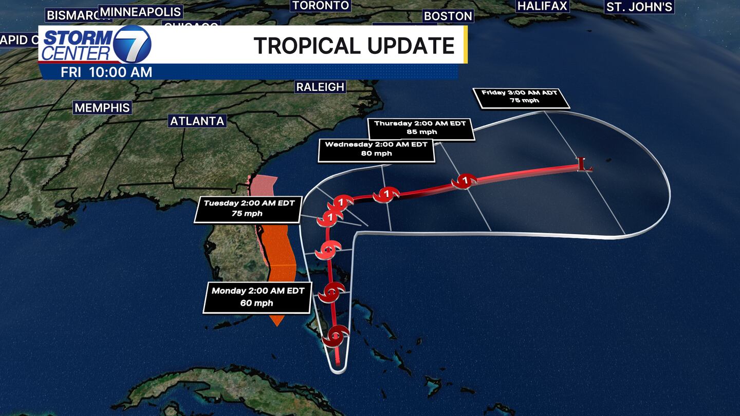
DAYTON — Tropical Depression (TD) Nine still has no name as of Sunday morning, and its track has been shifted. Hey it’s Stormcenter 7 Meteorologist Ryan Marando. Good news for our friends to the south in the Carolinas. The storm track has shifted significantly eastward keeping the center of the storm well off shore; however, they will likely still see heavy downpours and some coastal issues along the Carolina coast early this week. The east coast of Florida already has Tropical Storm watches and warnings in place.
[DOWNLOAD: Free Storm Center 7 Weather app for alerts as news breaks]
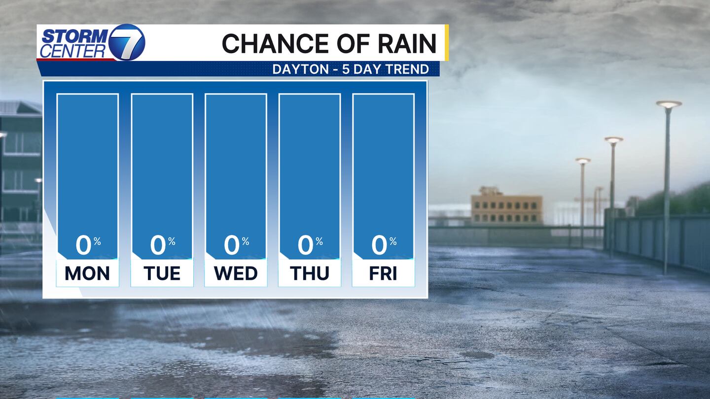
Back here at home, high pressure is the main steering force affecting our weather and affecting the track of TD 9. High pressure blocks the storm system from coming on shore and riding up the east coast. The biggest impacts we will see here is likely a few clouds tossed our way.
[WATCH Storm Center 7 Weather on the following devices]
High pressure though means we are staying dry for the next short while again. I’m not tracking many rain chances possible until past the first week of October. We will keep you posted!