DAYTON — Good evening, everyone. Weather Specialist Nick Dunn here to take a look at what is quickly becoming a grim situation for Jamaica. The tropics this year have largely been quiet in terms of land impacts compared to recent years. That is about to change in a big way for those in Jamaica, eastern Cuba, and parts of Haiti.
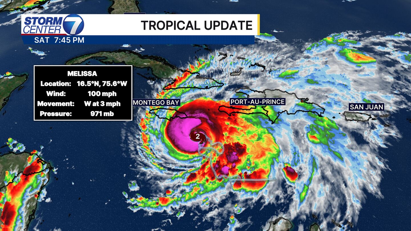
As of the latest update before 8PM, Melissa is Category 2 hurricane with winds of 100 miles per hour. This is an increase of 30 miles per hour from the 2:00 PM update earlier today. Of note, the movement is west at only three miles per hour. This is a bad sign over the next few days as rain and wind will hammer Jamaica for several days. Another sign the storm is quickly gaining intensity is the bright “pink” flare of convection in the core. This is a sign of cold cloud tops on this satellite imagery where convection is most intense.
The steering currents we look at aloft show no good signs to help “drive” Melissa anywhere quickly. This only compounds the issues of flooding and strong winds that will likely lead to catastrophic damage.
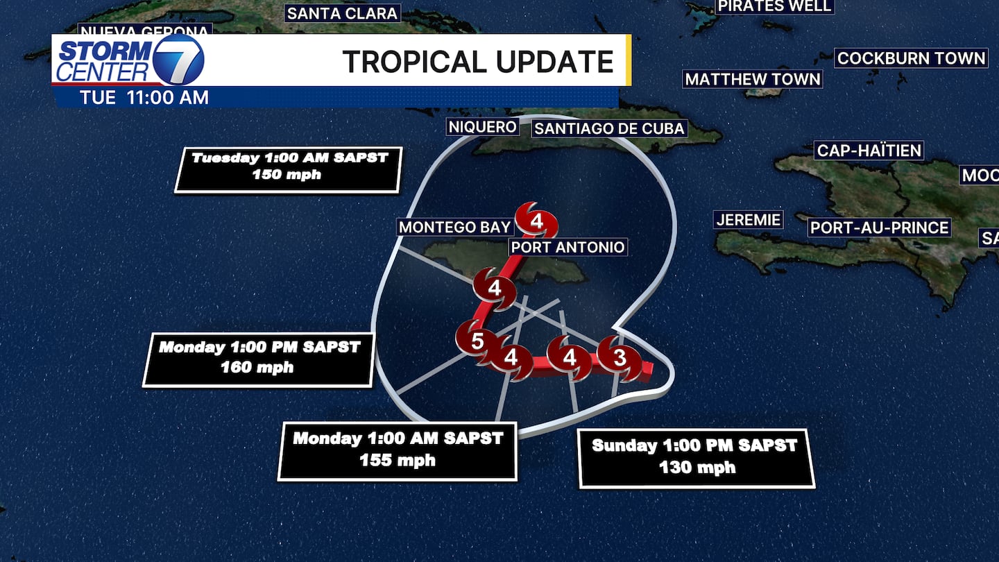
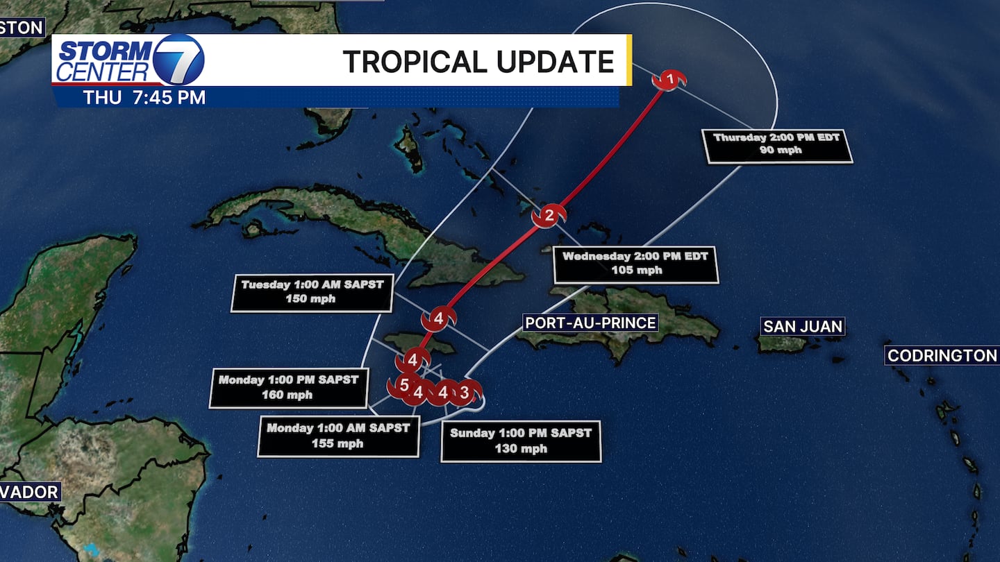
The latest track shows Melissa becoming a Category 5, at least briefly, Monday with winds of 160 miles per hour. Melissa is likely to make landfall Monday evening and slowly drift away by Tuesday. Should this verify, this will be the strongest hurricane to hit the island since Hurricane Gilbert in 1988, which was a Category 4 storm. Evacuations are underway for at least parts of the island.
[DOWNLOAD: Free Storm Center 7 Weather app for alerts as news breaks]
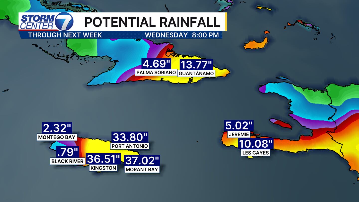
I mentioned the rain was a big concern. Check out the projected rainfall totals through Wednesday of next week. Some pockets of over 3 feet of rain are possible. For reference, that amount of rain is about what Kingston, Jamaica receives per year. The flooding concerns are heightened due to that amount of rain over a span of a few days.
[WATCH Storm Center 7 Weather on the following devices]
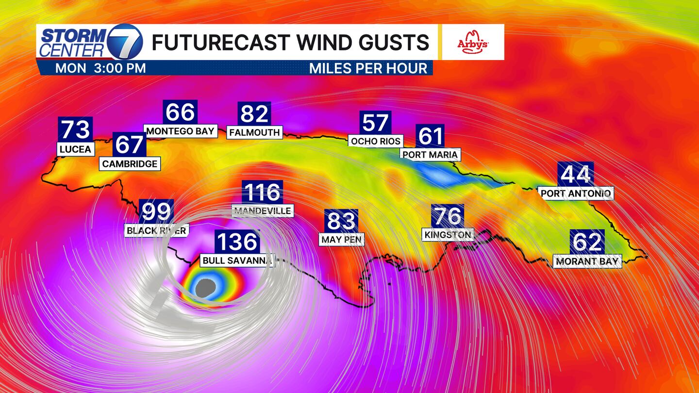
The future wind gust forecast shows Category 3+ wind gusts (111+ MPH) by Monday afternoon as the storm approaches. Keep in mind, the most intense winds are generally close to the core of the storm, but hurricane force gusts (74+ MPH) can extend several hundred miles away from the center of the storm.
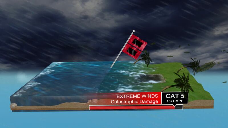
As a refresher, here is the Saffir-Simpson Scale that we use to rate the intensity of hurricanes.
We will continue to track this storm, but the good news is this will stay away from making landfall in the United States. Some higher waves and rip currents along the Atlantic Coast are expected, but no rain or wind impacts are expected as the storm eventually curves out to the open Atlantic.