
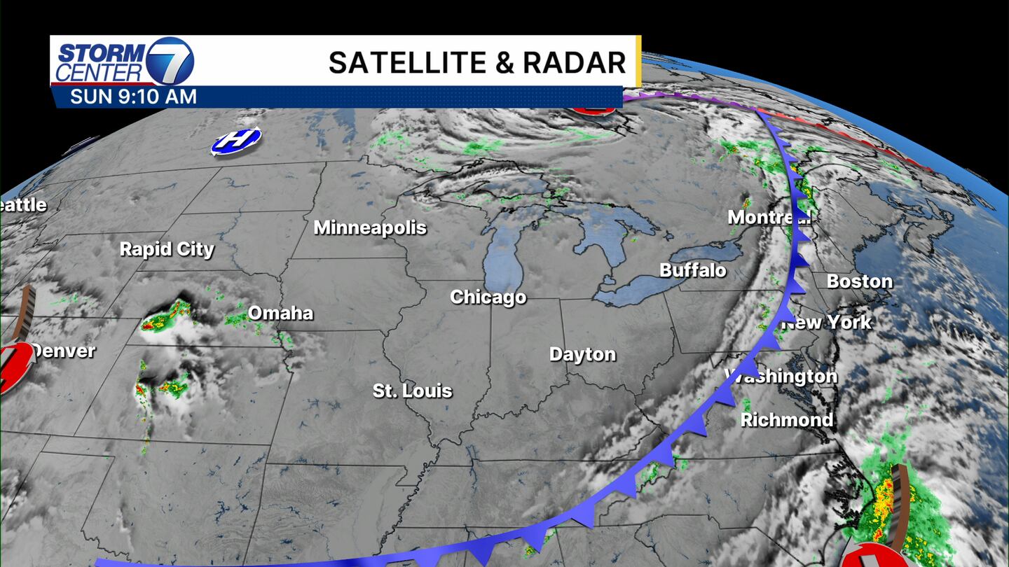
MIAMI VALLEY — Canadian high pressure is building over the Miami Valley, according to Storm Center 7 Meteorologist Ryan Marando.
[DOWNLOAD: Free WHIO-TV News app for alerts as news breaks]
High pressure usually brings clear, dry skies as air underneath it sinks and, by definition, dries out.
The position of the high pressure is important too for our temperatures, according to Marando.
TRENDING STORIES:
- At least 1 dead after semi truck flips onto side, closes parts of busy highway in Dayton
- Ohio officer arrested for suspected OVI after allegedly crashing into sheriff’s vehicle
- Football game postponed after shots fired near Ohio high school
The center will likely stay to our west, meaning our wind direction stays out of the northwest.
That will keep temperatures well below average for this time of the year, Marando said.
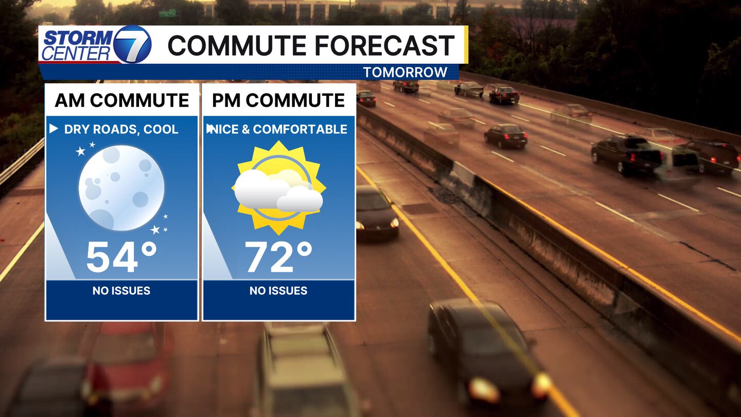
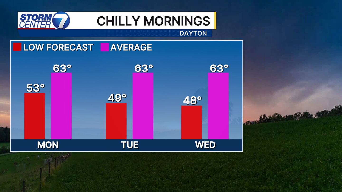
Monday morning starts the chill with low temperatures in the low 50s, while our average overnight low is in the mid-60s.
Tuesday and Wednesday will be the coolest mornings, with just about everyone dropping into the 40s, Marando said.
Definitely a time to break out the jackets. Lows will be running almost 15 degrees below average.
This is more typical of early October instead of late August, according to Marando.
The last time we had a morning low temperature below 50 degrees was June 2.
[SIGN UP: WHIO-TV Daily Headlines Newsletter]
©2025 Cox Media Group


