DAYTON — Good evening to all of you on this Friday! Meteorologist Nick Dunn here with you to give you an update on our weekend wintry system. This has not been a very easy one to forecast with multiple shifts in the storm track and temperatures. As an avid snow fan myself, I feel your frustrations with a forecast that changes several times. However, let’s dive in!
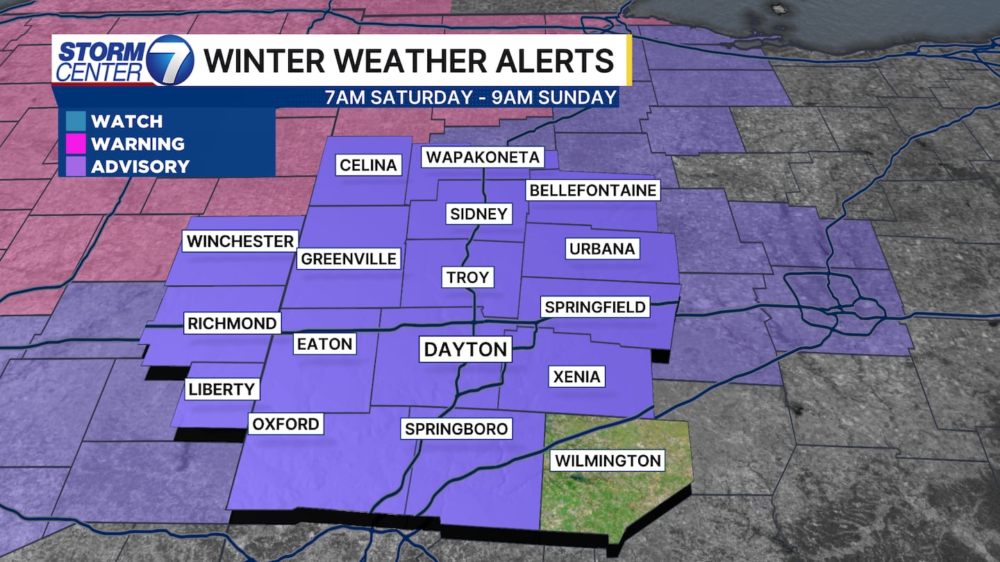
Everyone is under a Winter Weather Advisory, except Clinton County, from 7 AM Saturday to 9 AM Sunday. While this is not a major system, the timing combined with the various impacts with a holiday weekend are not the greatest as folks travel home. Winter Storm Warnings border the Miami Valley, but the heaviest snow stays just northwest of us the way it looks. In fact, there is likely to be a very sharp cutoff somewhere in our area.
[DOWNLOAD: Free Storm Center 7 Weather app for alerts as news breaks]
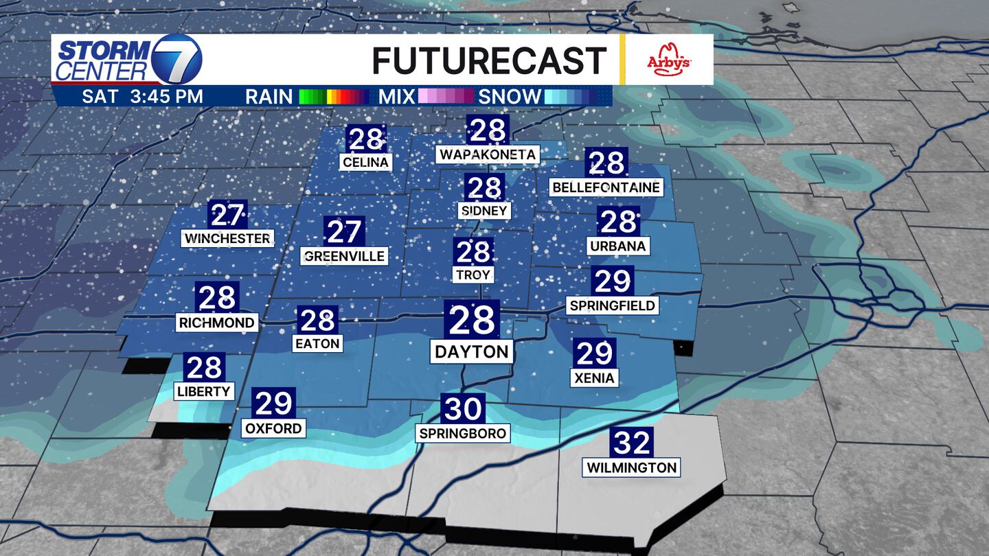
We will have one wave of snow impact mainly those near and north of US-35 move in during the middle portions of the day. This could be a decent thump of snow given cold temperatures in place. This would lead to snow covered roadways, but this wave will not last all day as a short break is expected. Wind will start to pick up as well, and that could add some blowing snow before temperatures warm and we turn into a water-logged type of snow that is good for making snowmen!
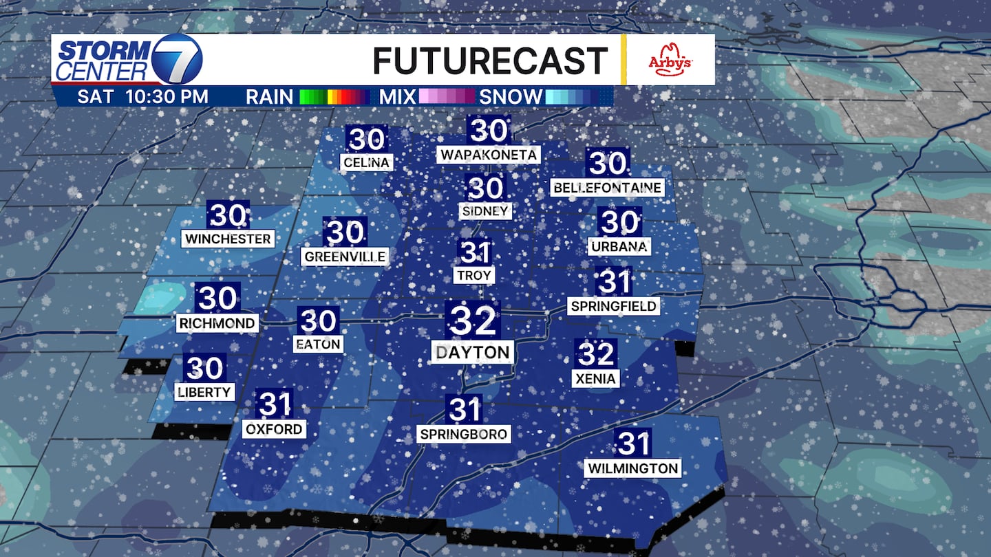
By late evening we find snow becoming heavy and widespread. But, notice the temperatures being a bit warmer? That will be a pivotal part of this forecast to watch to see just how warm we get into the overnight hours. While it snows, we add in gusts of 30+ miles per hour to cause reduced visibility and slick roadways. Untreated surfaces will likely turn slick as well.
After midnight is where things can get a bit interesting with warmer air moving in and temperatures rise above freezing. The winds will be southerly helping to pump in some milder air. But, the question will be just how warm can we get?
By early Sunday morning before sunrise we find snow changing to rain. Some guidance has been hesitant to bring rain or mixed precipitation all the way through the area. Given that uncertainty, that brings a lower confidence forecast. Travel impacts with slushy roads on untreated surfaces could persist into Sunday morning before things start to improve as we dry out.
Temperatrues will fall into the 20s through the day. We may have to watch for minor refreeze issues Sunday night as we get quite cold.
[WATCH Storm Center 7 Weather on the following devices]
A tight gradient of snowfall is expected across the Miami Valley. Conditions may vary greatly over short distances of 20-30 miles. If any additional shifts of small amounts occur the forecast could change further. Some of this may fall and then melt away as we find temperatures above freezing and/or rain and mixed precipitation occur.


