
As we move into the upcoming weekend, plan on hot and humid conditions in the Miami Valley. Highs will be in the upper 80s and lower 90s, which we are used to for mid-August! Those who want to enjoy summer weather should like these temperatures.
We are watching an interesting pattern this weekend where storm complexes known as “ridge riders” may dive through the Ohio Valley. The exact location, timing, and intensity can vary from one storm complex to the next, making it tricky for model data to be accurate at times.
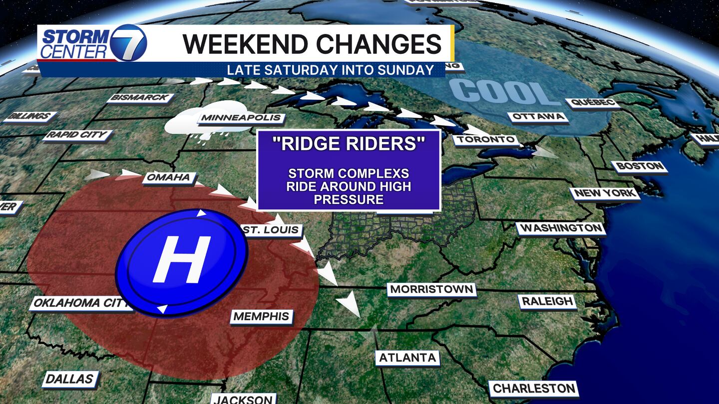
One of these complexes may dive into the Miami Valley Saturday night into early Sunday morning. Due to this, the Storm Prediction Center (SPC) has placed the Miami Valley in a Level 1 of 5 (Marginal) Risk for severe storms.

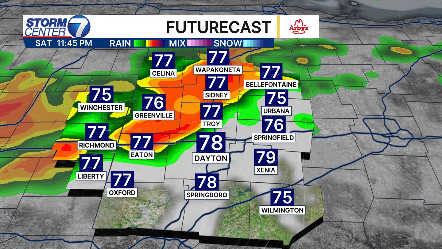
Futurecast shows a line of storms moving in just after 11PM Saturday, and the main concern with complexes like this would be for isolated damaging wind gusts. The timing being late in the evening would be better as lower instability would be present, but we will watch for any adjustments in later runs of model guidance. Overall, the current timing for severe storms looks to be from 11PM to 5AM, but this is subject to change as we see storms actually develop across the Great Lakes.
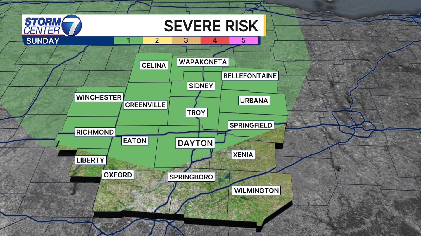
As we head into Sunday, the SPC has placed parts of the Miami Valley in a Level 1 of 5 (Marginal) risk for isolated severe weather once again. However, this will depend on how quickly storms exit into early Sunday morning. Should any storms try to redevelop, damaging winds would again be the main concern.
The StormCenter 7 Team will continue to monitor the latest. Be sure to download our WHIO Weather app to stay ahead of any developments and check the latest conditions for where you live.
©2025 Cox Media Group


