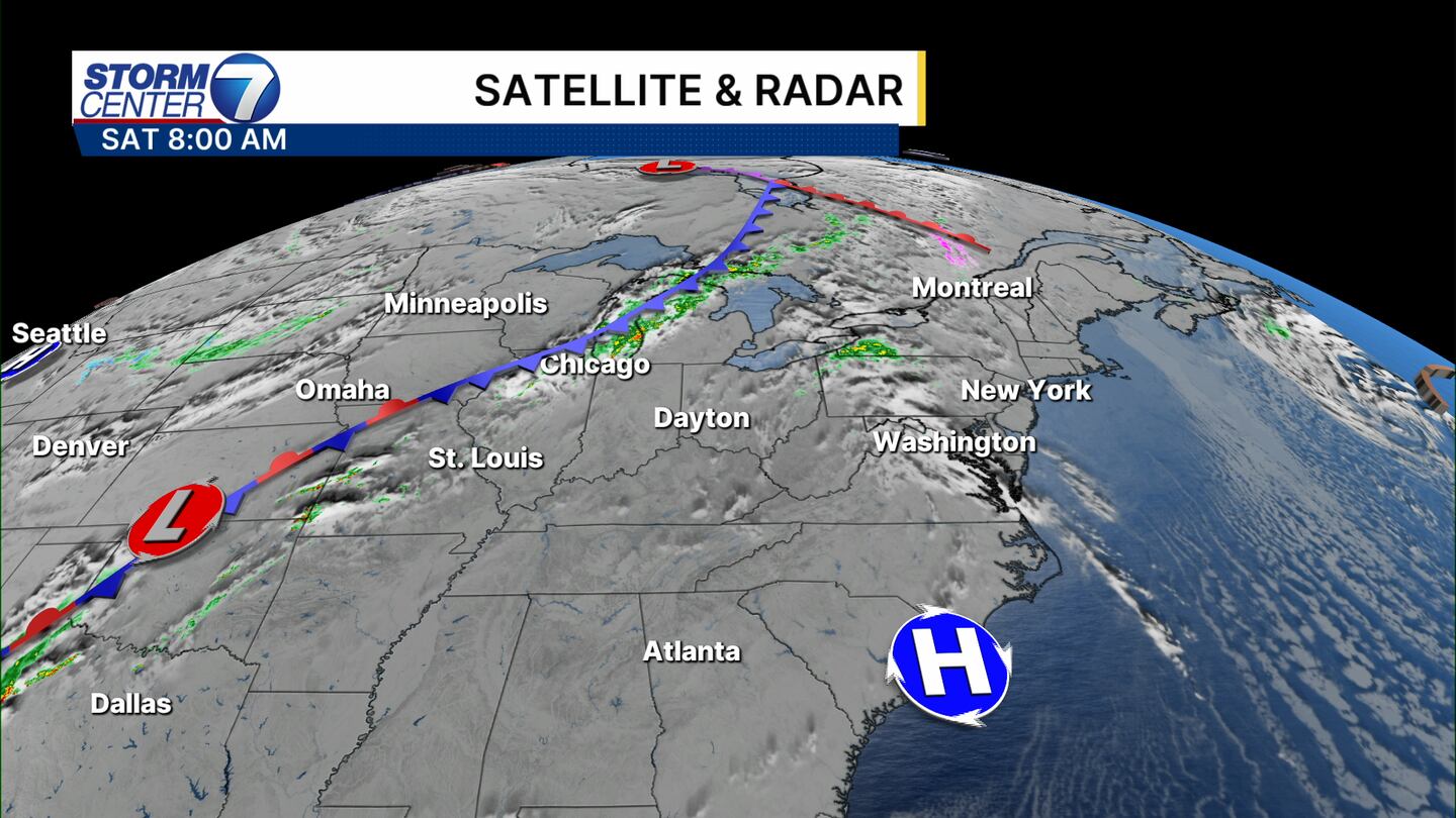
DAYTON — It’s been a good while since we had a stronger cold front bring heavy rain, high winds, and a severe weather risk to the Miami Valley. Here’s what you need to know through the weekend.
Our Saturday, ahead of the cold front, will be windy and warm. Highs are running over 15 degrees above average in the low 80s! This is thanks to a breezy wind out of the south, gusting to 25 mph Saturday.
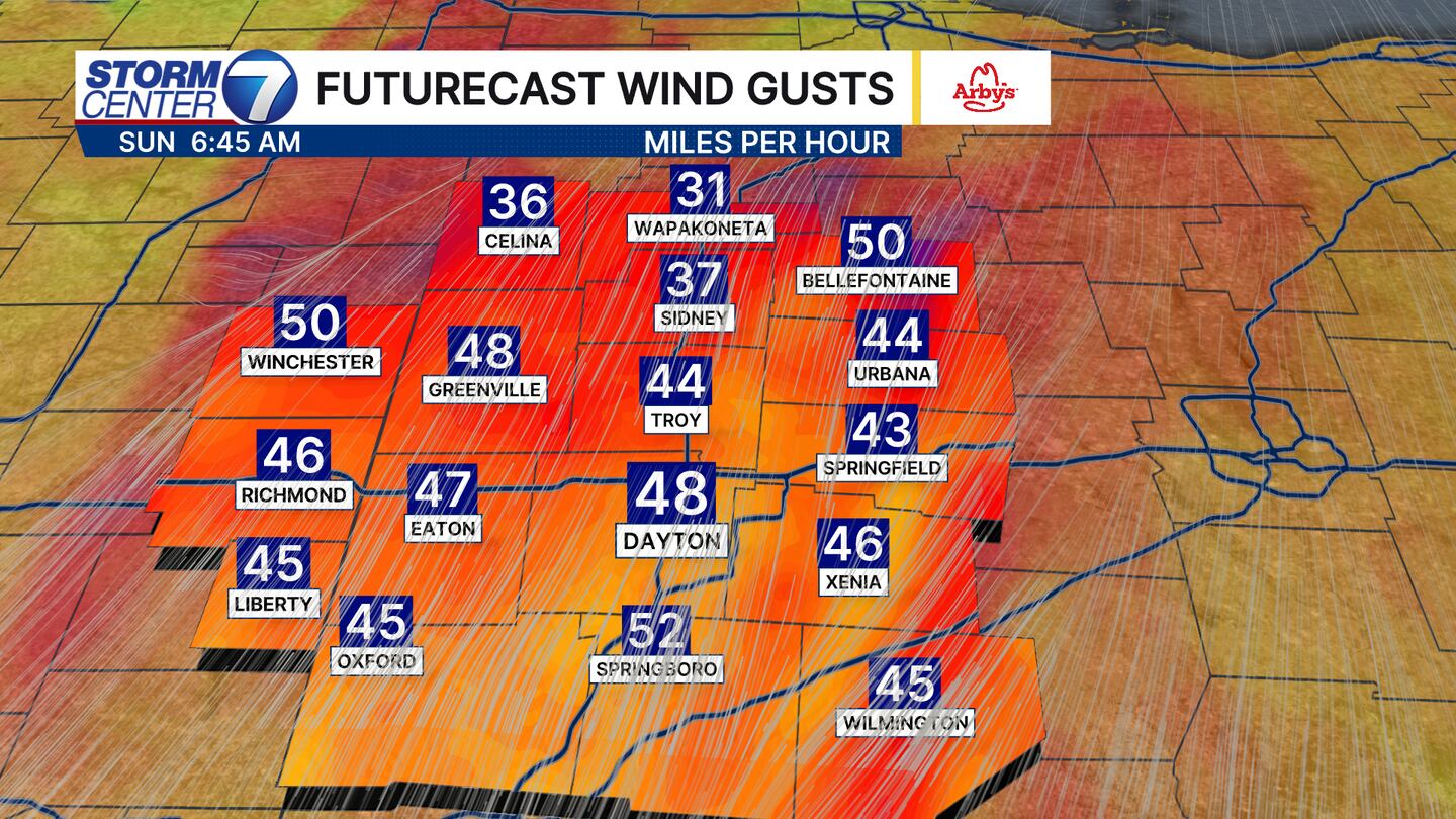
The highest winds come on Sunday morning. Even outside of thunderstorms, winds could gust upwards of 50 mph! That could blow around some outdoor furniture or trash bins.
[DOWNLOAD: Free Storm Center 7 Weather app for alerts as news breaks]
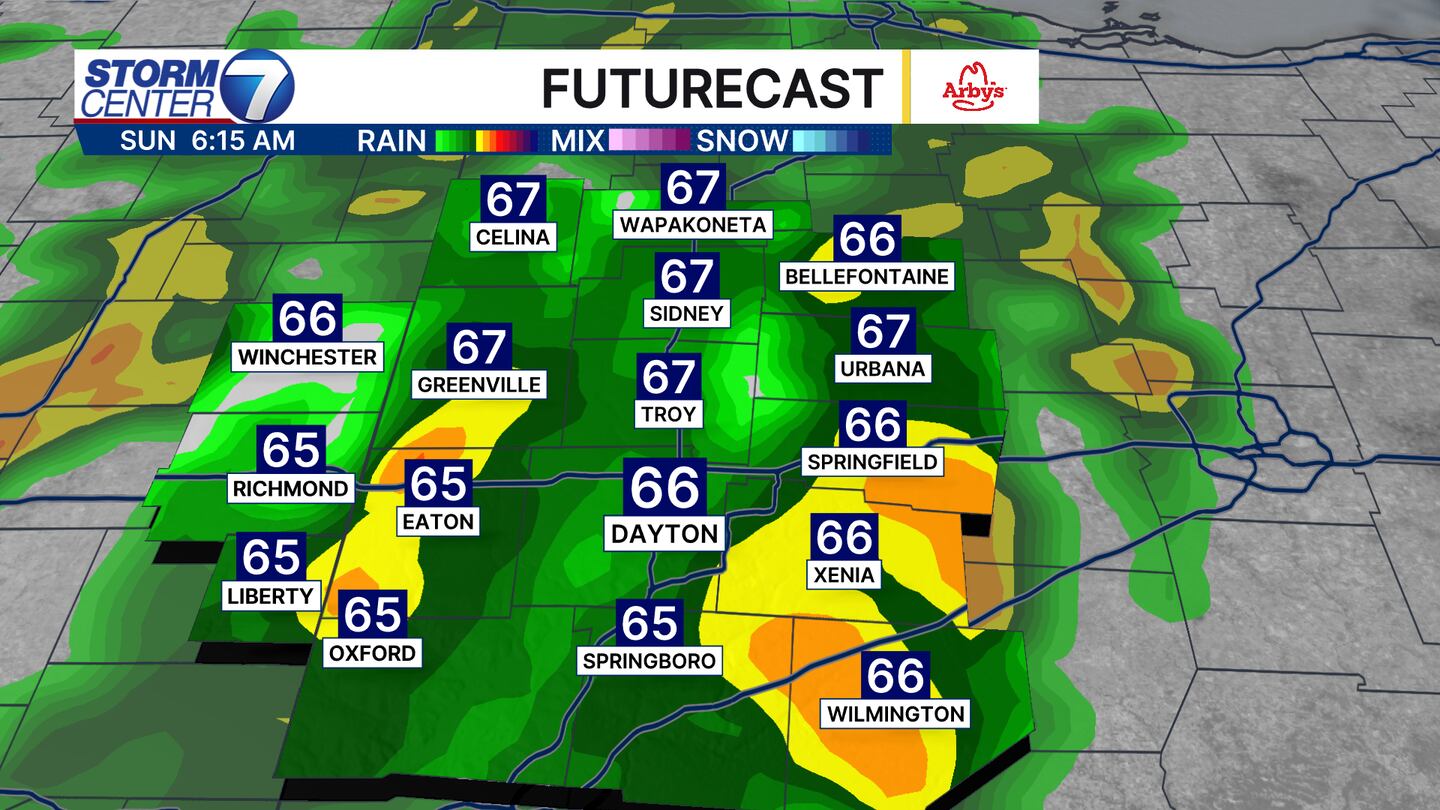
Most of the Miami Valley is under a 1 out of 5 severe weather risk for Sunday. This means of the rain and storms we see, only one or two may become severe producing damaging straight line winds. The brief tornado risk remains low.
[WATCH Storm Center 7 Weather on the following devices]
The worst of the weather will be around Sunday morning, although we may see another burst of more downpours Sunday evening.