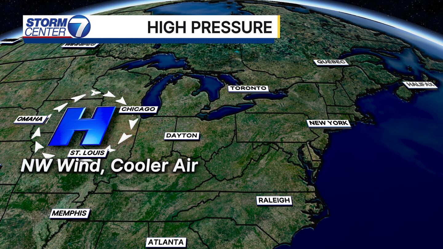
DAYTON - We are going on another roller coaster of temperatures over the next week. Stormcenter 7 Meteorologist Ryan Marando here, hope you’re having a great weekend so far! I’m tracking high pressure that’s moving in. High pressure means we get dry, clear skies in addition to temperature fluctuations.
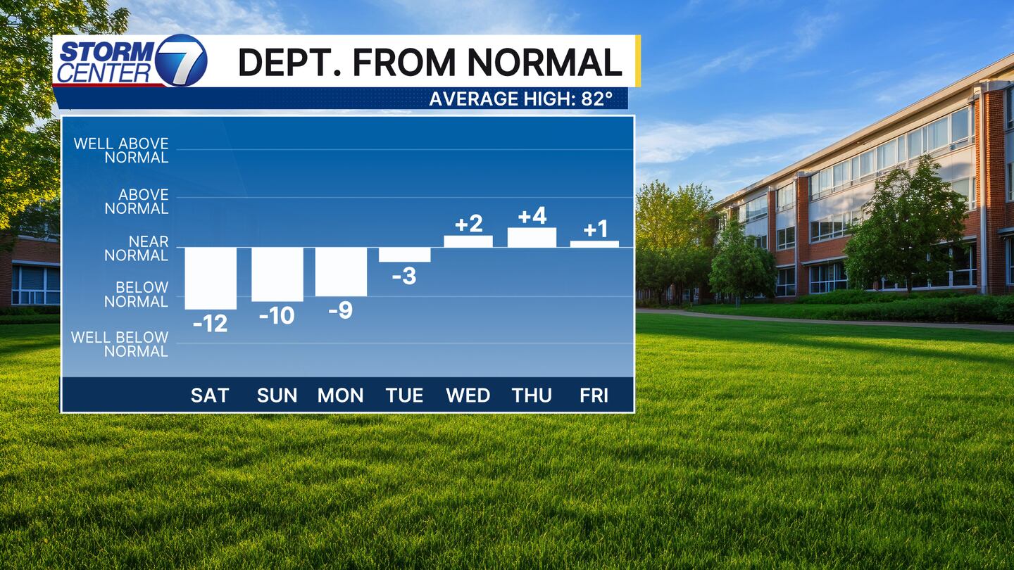
Saturday, high pressure is moving in and is to our west. Winds around a high pressure system are clockwise. This means we will have the winds out of the northwest this weekend keeping high temperatures about 10-12 degrees below average!
[DOWNLOAD: Free Storm Center 7 Weather app for alerts as news breaks]
We get the coolest mornings when the high pressure is right over top of us. This is due to the dry air, calm winds, and clear skies promoting very effective radiational cooling. Basically, all the heat we gained from the day escapes quickly to the upper atmosphere.
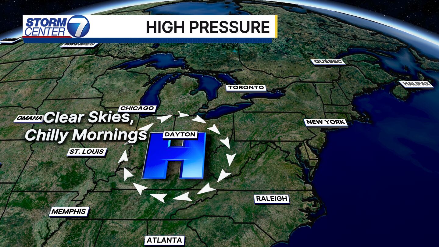
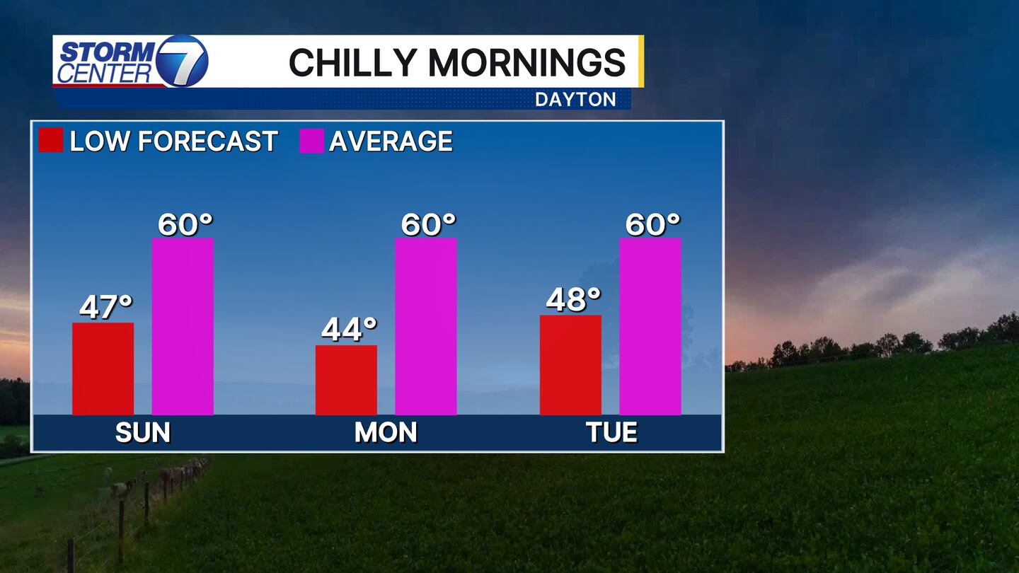
Mornings will be chilly though here! Down into the 40s!
[WATCH Storm Center 7 Weather on the following devices]
The return of a September summer comes when the high shifts to our east. This is when we get the warm, return wind flow out of the south.
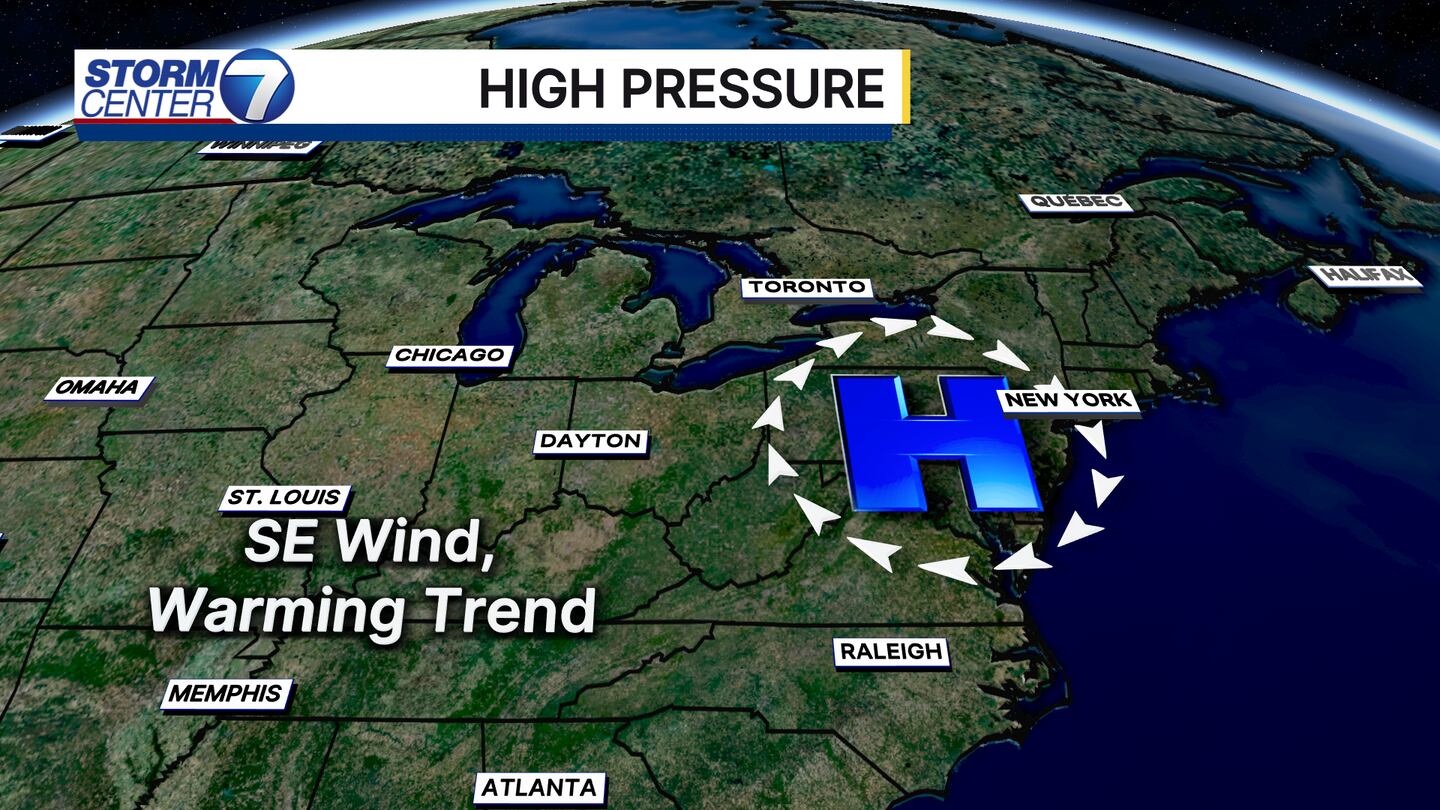
This will bump temperatures back to where they should be, in the low 80s, by the end of this upcoming work week.