
DAYTON, OH — Here comes the snow! It’s only December 1st, but winter continues to get off to a quick start. Tonight into Tuesday morning, widespread snow is again likely. This time, road impacts are likely as the snow will be coming through during an inopportune time.
[DOWNLOAD: Free Storm Center 7 Weather app for alerts as news breaks]
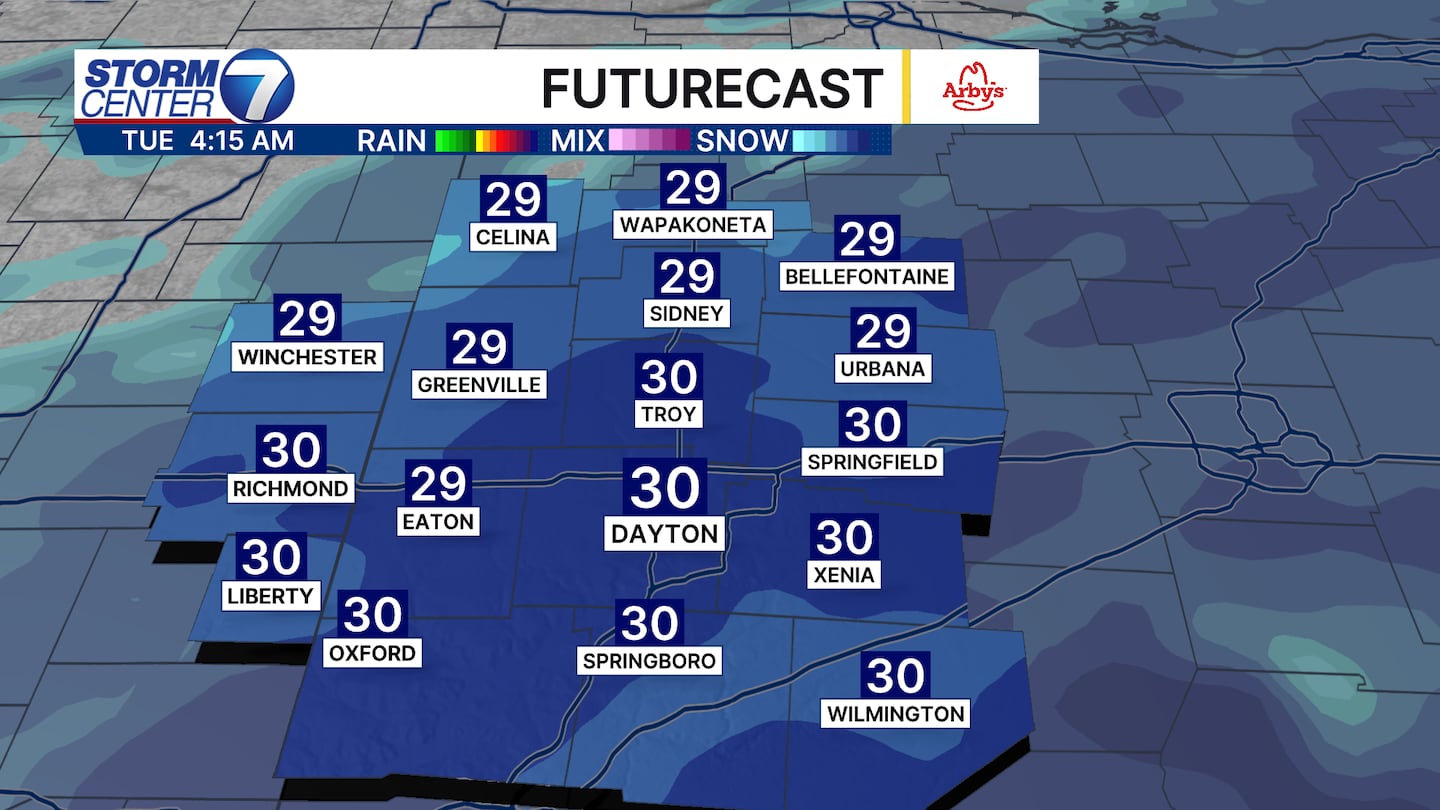
TIMING THINGS OUT: Expect snow to begin this evening, first northwest, then spreading southeast, after 7PM. The heaviest of the snow doesn’t arrive until after midnight.
Between midnight and 5AM, snow could be heavy at times, reducing visibility and creating difficult travel conditions. Snow will end Tuesday morning around daybreak.
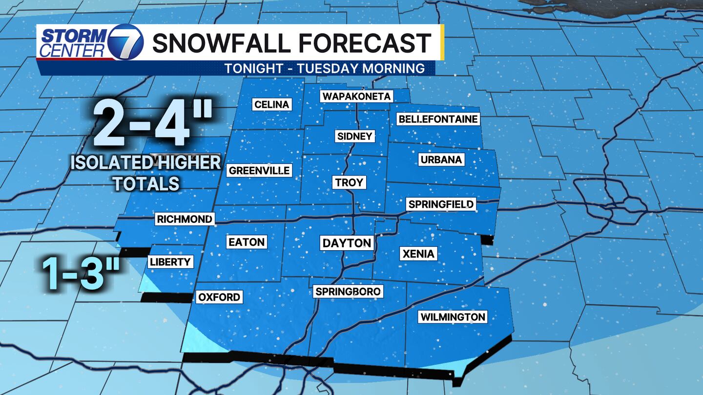
SNOWFALL TOTALS: Widespread 2-4 inches of snow seems likely. Some higher amounts can’t be ruled out wherever banding sets up. Those specific locations are difficult to predict.
[WATCH Storm Center 7 Weather on the following devices]
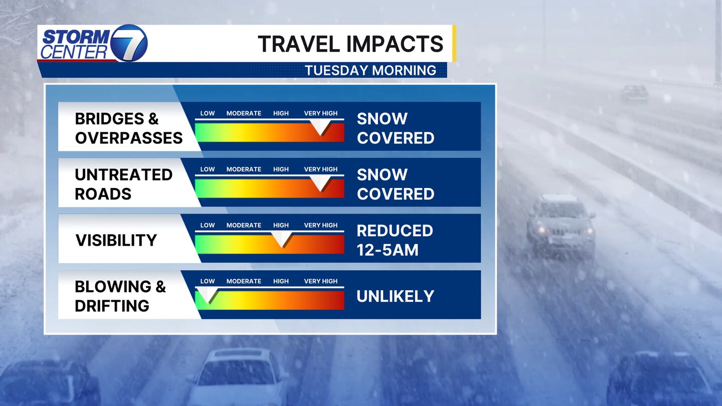
ROAD CONDITIONS: This system will create difficult travel. Bridge, overpasses, and untreated roads will quickly become snow-covered. Snowfall rates may become heavy enough early Tuesday morning to temporarily overcome the efforts of the road crews.
Visibility will be reduced in the areas of heavy snow. Fortunately, blowing and drifting are not particularly likely. All in all, messy conditions are expected through Tuesday morning.
Additional snow chances and very cold temperatures remain in the forecast through the next 7 days.


