DAYTON — The cold has returned, and it looks like it is here to stay for quite some time. For Thanksgiving day and Friday, we’ll struggle to climb back above freezing. Saturday, our next system collides with that cold air to produce a chance for snow.
[DOWNLOAD: Free Storm Center 7 Weather app for alerts as news breaks]
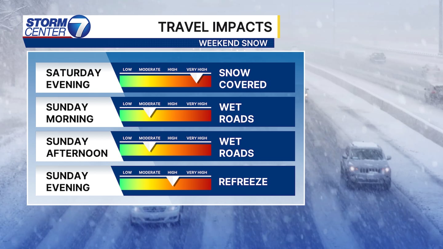
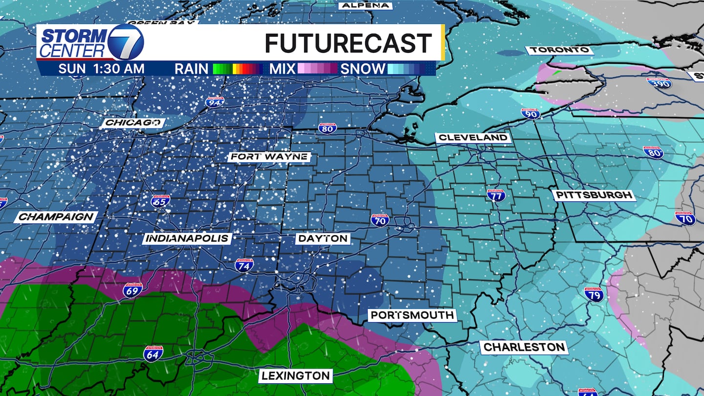
TIMELINE: The system should pass through sometime Saturday afternoon or evening through Sunday. We’ll be cold enough for this system to start out as all snow. Temperatures will rise going into Sunday morning, eventually above freezing, leaving us with either a changeover to rain or some wet snow by Sunday AM. Sunday afternoon, colder air returns and we go back to snow with any remaining moisture
[WATCH Storm Center 7 Weather on the following devices]
IMPACTS / TRAVEL CONCERNS: I do think this will be an accumulating snow for us, but the amounts are still difficult to say given the likelihood of rain mixing in for some time. If you have travel plans, I’d specifically watch out during the Saturday evening and overnight timeframe. The ground will have been cold for quite some time, so the snow wouldn’t have any problem sticking to the untreated roads. Road conditions should improve going into Sunday morning and then much of the day Sunday. We may have to watch out for moisture refreezing Sunday night.