DAYTON, OH — All eyes are now on our weekend storm system that will bring significantly colder air and the first chance of snow this season. Some of the trends today have pointed to a higher likelihood that this snow may stick to the grassy and elevated surfaces.
Storm Center 7’s team of meteorologists continues to monitor the progression of this system and the increasing confidence the region will see snow. Storm Center 7’s Austin Chaney breaks down the latest timing and impacts LIVE on News Center 7 at 5:00 and 6:00.
[DOWNLOAD: Free Storm Center 7 Weather app for alerts as news breaks]
On Saturday, we’re still waiting on this system to get here. Expect increasing clouds and high temperatures in the mid 50s. Pretty typical by November Standards.
Saturday night, low pressure approaches bringing rain. As wind shifts around to the north on Sunday morning, colder air arrives giving us a rain/snow mix on Sunday. Temperatures will be above freezing through the daytime hours on Sunday, so precipitation may be rain or snow at times but no accumulation is expected.
[WATCH Storm Center 7 Weather on the following devices]
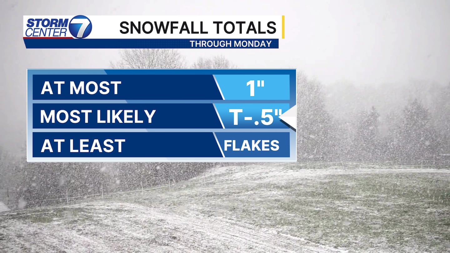
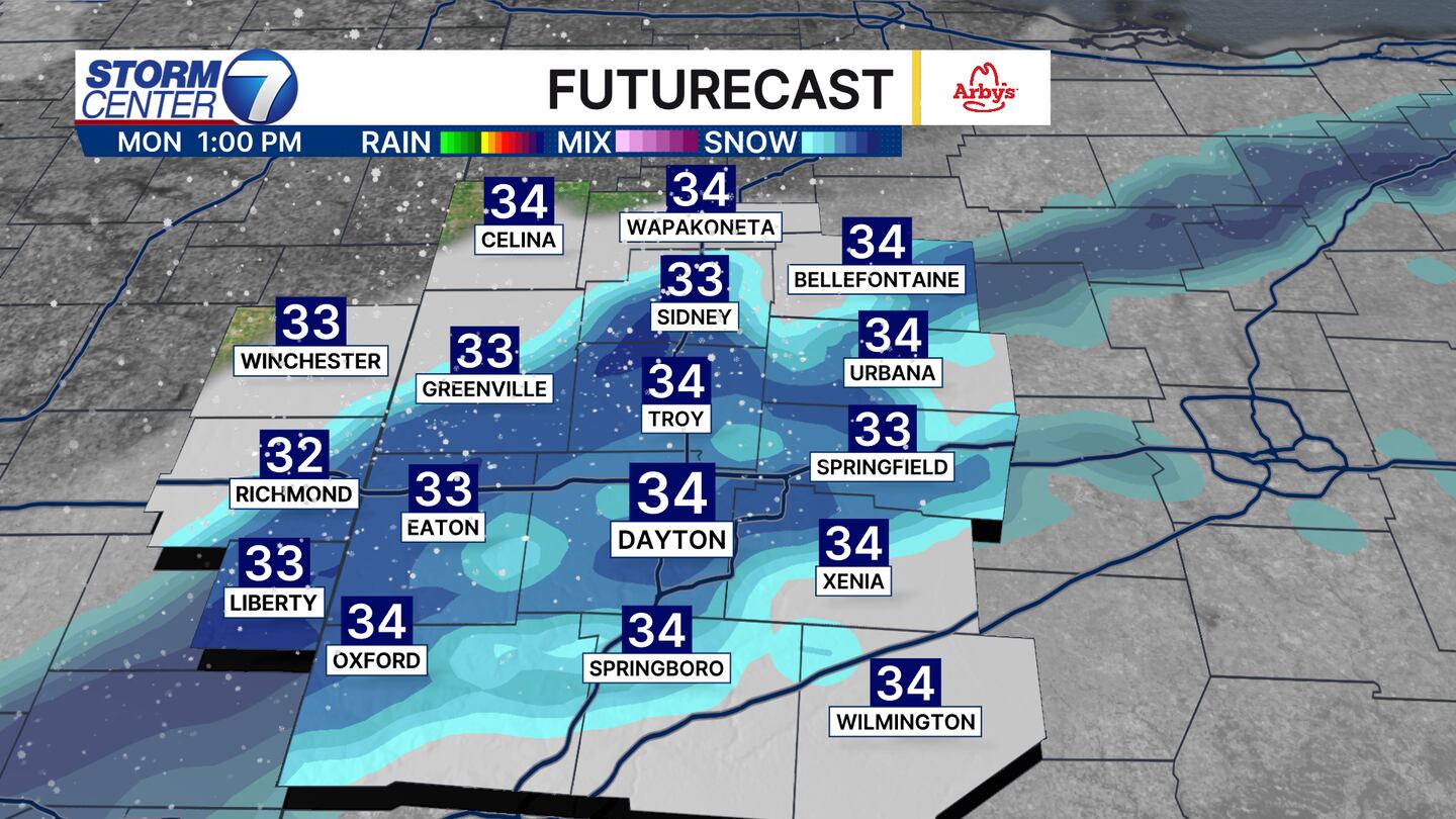
Sunday night into Monday, much colder air arrives. As temperatures fall into the 20s. All precipitation will fall as snow. Light accumulations of a dusting to .5 inches are possible on elevated surfaces. Road temperatures are currently well above freezing, and this will help to limit travel issues. We’ll continuously be updating the forecast for the timing of the rain/snow transition, amounts, and any impacts through the weekend.