DAYTON, OH — Tuesday was pretty quiet across the Miami Valley, but another storm system is set to arrive late tonight into early Wednesday. We still need the rainfall, and this next storm system promises to bring beneficial rain to the region, but also may bring a small risk for strong to severe thunderstorms.
[DOWNLOAD: Free Storm Center 7 Weather app for alerts as news breaks]
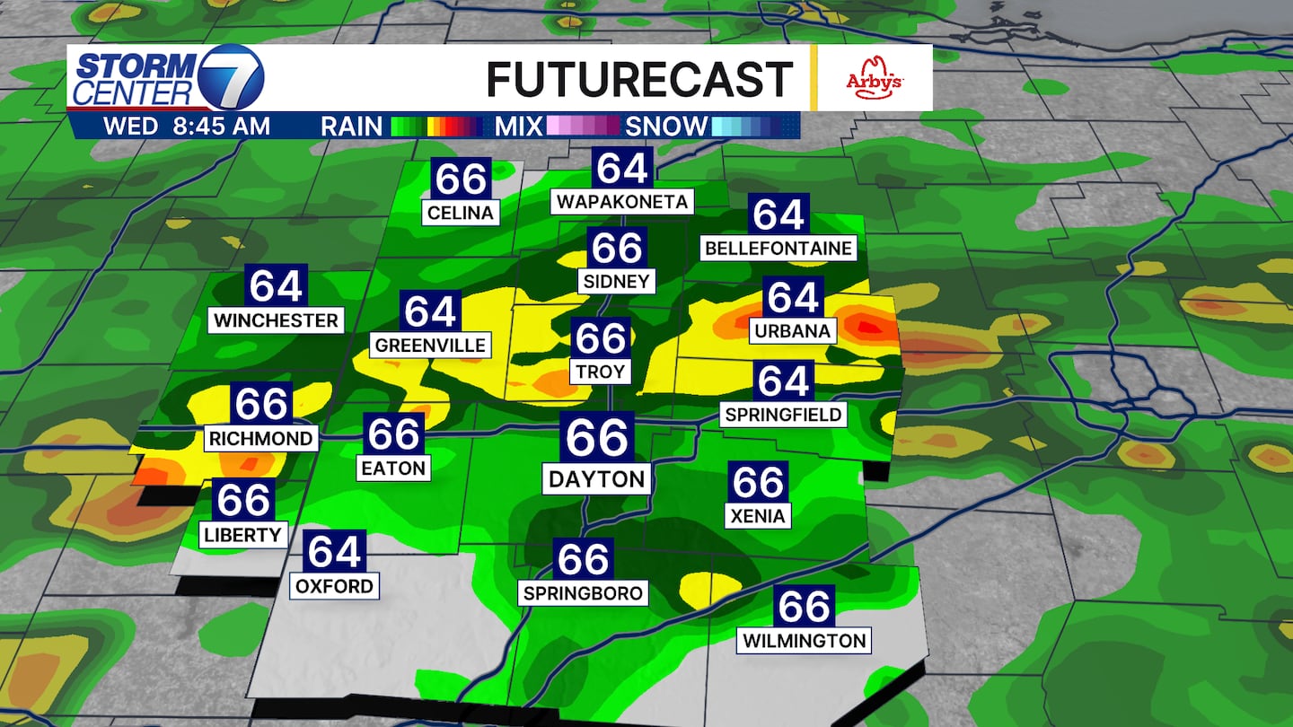
TIMELINE: The most widespread rain is likely during the morning hours on Wednesday, but scattered showers and a few storms remain possible into the afternoon. Clouds and lingering showers will be slow to exit - lasting into Thursday.
SEVERE WEATHER: The risk is not a big one, but one we’ll still keep a close eye on. The Storm Prediction Center is giving the Miami Valley a 1/5 risk for severe storms on Wednesday. If anything were to get strong, damaging winds is the main concern. Cool temperatures, and the timeline of the worst of the weather arriving during the morning should limit the overall severe weather risk.
[WATCH Storm Center 7 Weather on the following devices]
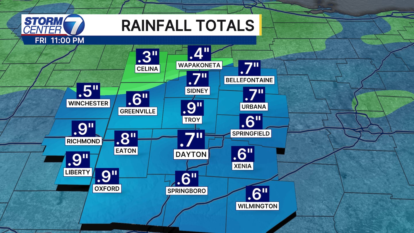
RAINFALL: An additional .5 inch to 1 inch or so of rain is likely through Thursday. Highest totals will likely fall from I-70 south.