DAYTON — No doubt about it, things are very dry across the Miami Valley. This weekend, we’ll have a small chance for showers and storms, but I wouldn’t get too excited quite yet.
In the upper levels of the atmosphere, there is a “ridge” of high pressure. Think of this as a mountain of air. The Miami Valley is on the eastern periphery of this ridge of high pressure. A weather disturbance is going to ride around the periphery of the ridge, but we may be just a little too far away to see major rain chances from this system.
[DOWNLOAD: Free Storm Center 7 Weather app for alerts as news breaks]
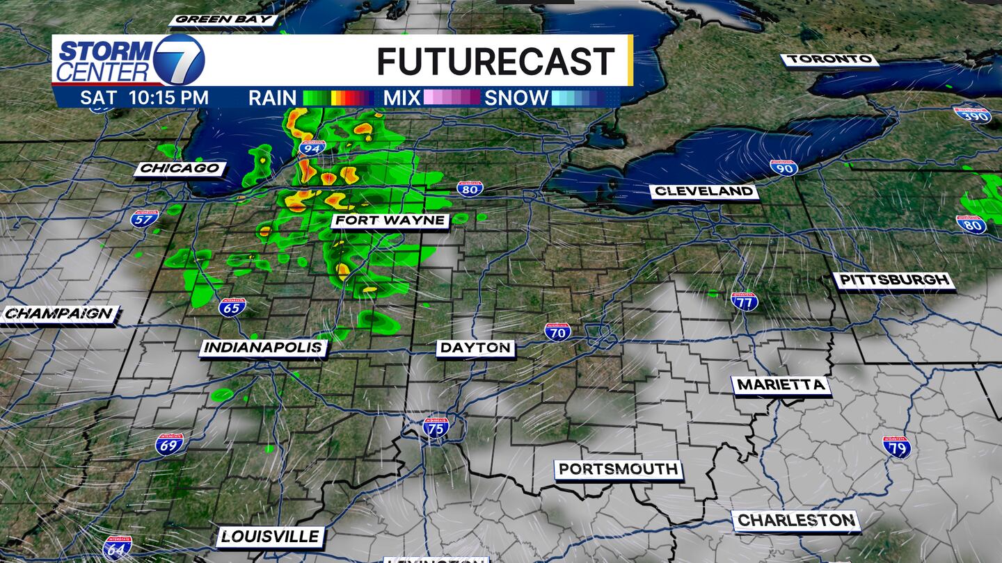
SATURDAY: Sunshine early, increasing clouds during the afternoon. We’ll watch an area of showers and storms approaching from the NW during the afternoon hours, but many of these will either fizzle out or miss us to the west in Indiana. We’ll leave in a 20% chance of showers and storms locally.
SUNDAY: Showers and storms likely redevelop across Indiana, but most will narrowly miss us. Again, we’ll leave in a 20% chance of showers and storms.
[WATCH Storm Center 7 Weather on the following devices]
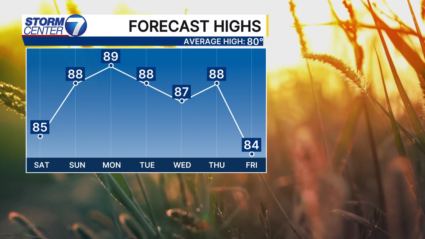
After that, it’s back to dry and warm weather for almost all of next week. Highs will climb to the upper 80s leading to the ground further drying out, and the likely expansion of drought conditions.