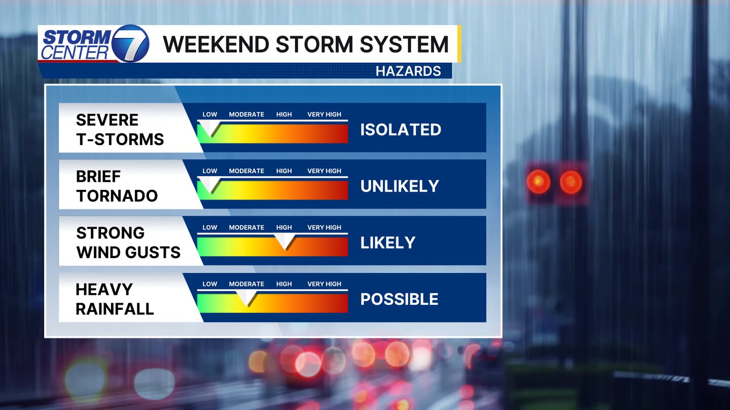
DAYTON, OH — A strong area of low pressure and associated cold front will move through the Miami Valley this weekend. The timeline of the worst of the weather has shifted a bit, but the expected impacts remain the same. Rain, strong winds, and isolated strong thunderstorms are all possible.
[DOWNLOAD: Free Storm Center 7 Weather app for alerts as news breaks]
BREAKING IT DOWN
Saturday will be a warm and breezy day. Wind gusts during the day could exceed 25MPH. An isolated thunderstorm or two will be possible during the day, but the better chance holds off until Saturday night and early Sunday morning.
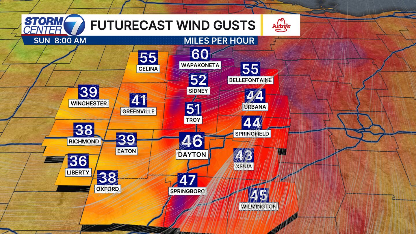
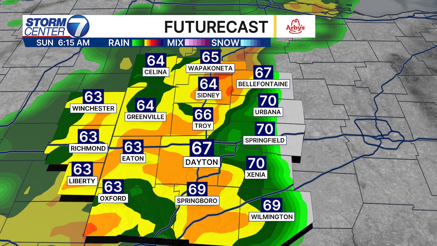
Saturday night into early Sunday morning brings the worst of the weather. A stout line of rain and storms will move through the area sometime between 3AM and 8AM. Heavy rain, wind gusts to 40 or 45MPH and even an isolated severe thunderstorm or two will be possible. While the risk is quite low, we cannot 100% rule out a brief spin-up tornado. I want to stress, the main threat we will face is the non-t-storm wind gusts.
[WATCH Storm Center 7 Weather on the following devices]
Sunday, more rain and wind wrap back into the Miami Valley. Scattered showers will be around all day long. Winds will continue gusting in excess of 30MPH. Temperatures will also be falling during the day. After reaching the mid 60s in the morning, temperatures fall sharply during the afternoon. By dinner time, some spots will be slipping into the 40s.